Michigan State Trunkline Highway System
The system is maintained by the Michigan Department of Transportation (MDOT) and comprises 9,669 miles (15,561 km) of trunklines in all 83 counties of the state on both the Upper and Lower peninsulas (UP, LP), which are linked by the Mackinac Bridge.
Predecessors to today's modern highways include the foot trails used by Native Americans in the time before European settlement.
Local township roads were financed and constructed through a statute labor system that required landowners to make improvements in lieu of taxes.
With the introduction of the Interstate Highway system in the 1950s, the state aborted an effort to build the Michigan Turnpike, a tolled freeway in the southeast corner of the LP.
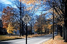
This usage dates from 1919, when Michigan's state trunklines were first signed along the roadways,[6] and continues to this day in official and unofficial contexts.
No discernible pattern exists in Michigan's numbering system, although most of the M-numbered routes lower than 15 are typically located in or around the major cities of Detroit and Grand Rapids.
[25] As of January 2013[update], there are three sources of revenue that contribute to the Michigan Transportation Fund (MTF): fuel excise taxes, vehicle registration fees and federal aid.
[27] Money from the MTF is distributed between MDOT, county road commissions, city or village street departments and local public transit agencies.
[28] For fiscal year 2013, MDOT has budgeted approximately $1.2 billion on the highway system, including $273.4 million in routine maintenance.
They were started in 1970 as a supplement to the main trunkline system and carry a letter-number combination on the national standard pentagon-shaped marker in blue and yellow.
The districts built farm-to-market roads to serve the agricultural needs of the farming population of the area at the time; they connected farmers with markets in their local communities.
[42] Reports of the first explorers and government surveyors crossing the future state only seemed to confirm the assessment that Michigan land was unsuitable for agriculture or other productive activities.
In time, the logs would rot, leaving large gaps to the roadway that would catch wagon wheels or draft animal feet.
[45] Even Mark Twain remarked, "The road could not have been bad if some unconscionable scoundrel had not now and then dropped a plank across it," after a trip to Grand Rapids.
Horatio S. "Good Roads" Earle, a state senator from Detroit, was elected national president of the League of American Wheelmen in 1901.
[54] Passage of the State Reward Trunk Line Highways Act on May 13, 1913, provided for 3,000 miles (4,828 km) of roadways in a state-financed system.
[56] Further legislation at the time allowed for special assessment taxing districts for road improvements, taxation of automobiles based on weight and horsepower, and tree-planting along highway roadsides.
[62] Alan Williams, Ionia County engineer, helped to design the diamond marker used to sign the highways; he is also known for placing a picnic table alongside US 16 (Grand River Avenue) in 1929 south of Saranac, considered the first in the country.
The existing tri-level system was maintained, splitting road jurisdiction between the state, counties and cities, as well as subdividing each level into several classifications.
[71] The Michigan Turnpike Authority (MTA), an agency created in 1951,[70] proposed the construction of a toll freeway to run north–south in the state.
Seizing the opportunity brought by a 1957 state law, the department sold $700 million in bonds (equivalent to $5.81 billion in 2023[54]) in the late 1950s and early 1960s to finance land purchases and construction of the new freeways.
[82] The original goal of Michigan's freeways was to connect every city with a population of more than 50,000 people with a network of roads that would accommodate traffic at 70 mph (110 km/h).
Following the start of these highway improvements, the MSHD adopted a policy to allow traffic to use the state's trunklines every day of the year regardless of the weather.
[86] The State Highway Department started erecting mileposts along the Interstates in 1963, and later expanded the practice to other freeways and used the mileages to number the interchanges along I-94.
[89][90] The final section of I-75 between Alger and Roscommon was opened on November 1, 1973, in a dedication by Governor William G. Milliken,[91] completing the longest highway in the state.
These ventures, along with the I-275 extension, were dropped over concerns related to rising construction costs, the environment and the Arab Oil Embargo.
[98] At the end of the 1970s, MDOT took part in a FHWA-backed initiative called the Positive Guidance Demonstration Project, and the two agencies audited signage practices in the vicinity of the I-96/M-37 and I-296/US 131 interchange in Walker near Grand Rapids.
They approached the department's Trunkline Numbering Committee and the district traffic and safety engineers on October 19, 1982, for proposals to reduce or eliminate the various overlapping designations to "avoid driver confusion and save funds".
The project cost $121.5 million dollars and involved relocating the interchange with the eastern terminus of BL I-94 and reconstructing 3.5 miles (5.6 km) of I-94 in the area.
[133] MDOT examined three options to build the freeway,[134] but abandoned further study after June 12, 2001, diverting remaining funds to improvement of safety along the corridor.