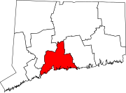
Milford, Connecticut
Milford is part of the South Central Connecticut Planning Region and New York metropolitan area.
Because of its location on Long Island Sound, Milford became a beach resort for residents of New Haven and Bridgeport in the latter 19th century.
[6] The bridge was described as "simple in design, its broad copings surmounted with rough hewn blocks of granite, bearing the names of the first settlers.
Milford was one of the early settlements in south central Connecticut and, over time, gave rise to several new towns that broke off and incorporated separately.
Starting in 1902, Quaker Oats oatmeal boxes came with a coupon redeemable for the legal deed to a tiny lot in Milford.
Since the subdivision into small lots predated Milford's planning and zoning regulations, the deeds were entirely legal, although they created a large amount of paperwork for town tax collectors, who frequently couldn't find the property owners and received almost no tax revenue from the lots.
One notable small business located on the Boston Post Road during the 1970s was SCELBI Computer Consulting, credited by many as being the world's first personal-computer manufacturer.
[9][10] The city became host to several headquarters of multinational corporations, including the Schick Shaving company,[11] and Doctor's Associates, Inc., owners of the Subway chain of fast-food restaurants.
According to the 2010 US census Demographic Profile Data, there were 51,271 people living in 21,017 housing units of which 13,534 were counted as family households.
[14] Government in the city is set up with the mayor as chief executive and the Board of Aldermen as a legislative body.
It elected its first mayor, Charles Iovino,[16] the incumbent city manager under Milford's previous form of government, on November 3, 1959.
†: Denotes that the community is chartered by Special Act of the Connecticut General Assembly and have been granted some of the powers normally held only by a municipality including taxing authority.
[48] Every year on the third Saturday in August, Milford celebrates its annual Oyster Festival, which serves as a combination of a typical town fair with a culinary celebration of the town's location on historically shellfish-rich Long Island Sound.
According to the "Encyclopedia of American Food and Drink"[49] the lobster roll originated as a hot dish at a restaurant named Perry's as early as 1929.
[49][50] This festival takes place in and around the Milford Green, near the center of town, as well as in various locations throughout the downtown area, and features a wide variety of events including canoe and kayak races, musical performances, and classic car shows.
[citation needed] There are also other features such as carnival rides, food stands, crafts, face painting, and even opening your own oyster for a pearl.
The beach resort quality of the town lives on, with several rocky beaches, Silver Sands State Park, the Connecticut Audubon Society Coastal Center at Milford Point, Charles Island, two golf courses, and numerous other recreational facilities available for residents and tourists.
[53] Milford's Devon neighborhood[54] is located at the mouth of the Housatonic River near Stratford, and features the Connecticut Audubon Coastal Center overlooking the estuary.
Milford has over 14 miles (23 km) of shoreline facing Long Island Sound, the most of any town in Connecticut.
A newly built 3/4 mile boardwalk was opened in 2011 that connects Silver Sands to Walnut Beach in Devon.
There is a sandbar (called a tombolo since it is perpendicular, not parallel to the coast) accessible during low tide that people can walk on from Silver Sands Beach to Charles Island.
[20] The island is a part of the Hamonasset-Ledyard Moraine and was formed as glaciers retreated at the end of the last ice age.
The Wisconsin glaciation formed drumlins in Milford: Clark, Burwell, Eels, Bryan and Merwin hills.
The Wilbur Cross Parkway cuts across the northern part of the city and is connected to I-95 and Route 1 via the Milford Parkway, also known as the Daniel S. Wasson connector, named for the first police officer to die in the line of duty in the city of Milford.