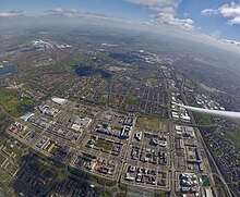
Milton Keynes urban area
The wider urban area outside that designation includes Newport Pagnell and Woburn Sands as well as Aspley Guise (Bedfordshire) and part of Stoke Hammond civil parish.
As of June 2023[update], information about the definitions and populations of the built-up area subdivisions of the 2021 census has yet to be released.
In defining the sub-areas of the Milton Keynes urban area for the 2001 census, the ONS used the pre-designation urban and rural districts, subdividing the larger rural district by the chronological phases of urbanisation within them).
The "Walnut Tree" and "Browns Wood" sub-areas together cover the remainder of the Rural District from the Ouzel to the M1.
(The precise boundary mapping is no longer available: the information in the notes below was derived at the time.)