Miryang
Neighboring cities include Changnyeong to the west, Cheongdo to the north, Ulsan to the east, and Yangsan, Gimhae, and Changwon to the south.
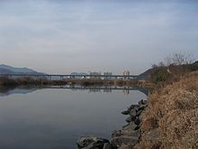
Due to its strategic location near the Nakdong River, Miryang played an important role from the Silla period forward.
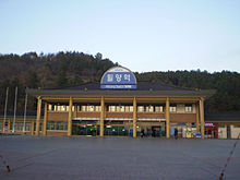
Miryang remains a key stop along that line, and is now the only city between Busan and Daegu served by KTX express trains.
Famous people from Miryang include 15th-century Neo-Confucian scholar Kim Chong-jik and 16th-century warrior-monk Songun Yu Jeong.
The city government works actively to maintain the memory of these figures, and of other local cultural features such as the tale of Arang.
[3][4][6] During the Samhan, Miryang may have been part of the territory of Mirimidongguk, one of the Byeonhan tribes mentioned in the San guo zhi.
[7] Under King Chungnyeol in the late 13th century, local residents led by Jo Cheon rose up against the government; in retaliation, Mil-ju was demoted to a tributary village of Gyeongju (then Gyerim).
Under Japanese rule, Miryang was the site of various clashes between the Korean independence movement and the occupation forces.
During the March First Movement of 1919, approximately 13,500 Miryang residents took part in peaceful demonstrations in support of Korean independence.
[8] In November 1920, independence fighter Choe Su-bong built and detonated two bombs at the Miryang police station, destroying the structure.
The city's topography generally slopes from the high peaks of the Yeongnam Alps in the northeast to the Nakdong valley in the southwest.
This area, including large portions of Samnangjin-eup, Sangnam-myeon, and Hanam-eup, serves as a local breadbasket and is almost entirely devoted to rice-farming.
Steep mountain valleys abound; these are often used for reservoirs that store water for irrigation or drinking purposes.
[11] Miryang is divided into 16 primary divisions, of which 2 are eup (large villages [towns]), 5 are dong (city precincts [neighborhoods]), and 9 are myeon (rural areas [townships or sub-counties]).
Like other cities and counties in South Korea, Miryang enjoys a limited degree of local autonomy.
By road, Miryang is served by two exits on the Daegu-Busan Expressway, as well as numerous national and local highways.
This is sometimes considered to be close to the original version of the arirang, which may have drawn its name from the Miryang area folktale of Arang.
The Miryang Arirang Festival is held each May to commemorate and keep alive this tradition and other aspects of local heritage.
[21] The history of education in Miryang can be traced back to the Goryeo period, when a hyanggyo, a government-run village school, was constructed in the town center (modern-day Gyo-dong).
This school, famed for its size,[22] continued in operation through the Joseon period, although it was gradually supplanted by numerous local seodang and seowon.
[23] Supplementary private education is offered through hagwons, which are strongly concentrated in the city center, with some in outlying towns.
The northeastern corner of the city occupies a portion of the Yeongnam Alps; part of this region is included in Gajisan Provincial Park.