Mississippi Gorge Regional Park
The 132-acre (53 ha) park (acreage for Minneapolis parkland only[2]) provides access to the river and is popular for its hiking and biking paths on the bluffs.
[7] A 72-mile (116 km) corridor of the Mississippi through the Twin Cities was designated by Minnesota Governor Wendell Anderson in 1972 as a critical natural resource area.
In recent years, communities and park agencies have formed partnerships to improve the ecologic health of the gorge.
[10] Bohemian Flats - The location of the historic Little Bohemia shanty town has picnic areas and river cruise boats.
Mountain biking is prohibited on all natural surface trails in the gorge due to threats of erosion and potential damage to native plants.
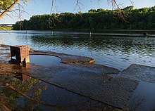
The mostly natural-surface hiking trail provides access to the floodplain forest, sandy beaches, and an oak savanna restoration project.
Several limestone staircases constructed by the Works Progress Administration descend from the West River Parkway to the gorge floor.
[21] Canoes and kayaks can be launched as several locations in the gorge with routes from Hidden Falls and the rowing club boathouse most recommended.
[22] The locks and dams on opposite ends of the gorge have closed permanently to commercial and recreation traffic to block invasive carp species.