Mohave County, Arizona
Mohave County makes up the Lake Havasu City–Kingman, Arizona Metropolitan Statistical Area.
The Kaibab, Fort Mojave and Hualapai Indian Reservations also lie within the county.
The county territory was originally defined as being west of longitude 113° 20' and north of the Bill Williams River.
The county is also notable for being home to a large polygamous Fundamentalist Church of Jesus Christ of Latter-Day Saints sect located in Colorado City.
[5] It is the second-largest county by area in Arizona and the fifth-largest in the contiguous United States.
The county consists of two sections divided by the Grand Canyon, with no direct land connection between them.
The northern section, smaller and less populated, forms the western part of the Arizona Strip, bordering Utah and Nevada.
The larger southern section borders Nevada and California across the Colorado River, which forms most of the county's western boundary.
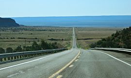
The southern section includes Kingman, the county seat, and other cities, as well as part of the Mojave Desert.
They include the #1 (San Bernardino), #2 (Coconino), #5 (Mohave), and #7 (Lincoln) largest counties outside of Alaska.
Since 2008, Mohave has taken over from Graham and Yavapai as the “reddest” county in the state, and in 2024, it stood as such by twenty-one percentage points.
No Democratic presidential nominee has carried Mohave County since Lyndon Johnson, who, despite the home state advantage of Arizona native Barry Goldwater, did so in 1964, by a margin of only 152 votes.
[1] The Mohave County Administration Building is located in downtown Kingman at 700 West Beale Street.
The Mohave County Superior Courthouse, built in 1915, is an Art Deco/Streamline Moderne building on the National Register of Historic Places.