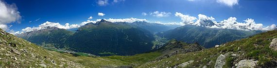
Mont Cenis
The descent lies through the Cenis Valley to Susa (49.9 km / 37 mi from Modane) where the road joins the railway.
The tunnel is 13 km in length, and leads to Bardonecchia, some way below which, at Oulx the line joins the road from the Col de Montgenèvre.
In the Middle Ages, pilgrims passing through Moncenisio and Susa Valley came to Turin along a road called the Via Francigena, with a final destination of Rome.
In 1414, Niccolò III d'Este, Marquis of Ferrara travelled on this route returning from Paris having met Charles VI, and described the Col du Mont Cenis as having "a good ascent and bad descent".
It was also used as the main passage by which Charlemagne crossed with his army to invade Lombardy in 773, and later by Napoleon I. Mont Cenis was one of the most used Alpine passes from the Middle Ages to the nineteenth century.
The pass was part of the border between the two countries from the annexation of Savoy to the Second French Empire in 1861 until the 1947 Treaty of Paris, but is now located completely in France.
Two further armored batteries, La Court and Paradiso, were added in the early 20th century, while the Fascist government built here part of its underground Alpine Wall.
The Lac Du Mont Cenis is an artificial dam that was constructed in 1921 on top of the original road and border crossing.
Even the warmest months of July and August, the temperature rarely rises above 25 °C (77 °F), and often falls below minus −20 °C (−4 °F) in severe winter.