Montgomery County, New York
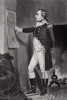
[3] The county was named in honor of Richard Montgomery, an American Revolutionary War general killed in 1775 at the Battle of Quebec.
When the British lost, they ceded all the Iroquois territory of the Six Nations (the Tuscarora had joined the confederacy in the 18th century) to the United States, without consulting the tribes or bringing them into negotiation.
Under the terms of the charter, the Board of Supervisors was replaced by a nine-member County Legislature, with members elected from single-member districts.
Thomas L. Quackenbush, one of the members, was elected as the first chairman of the new legislative body, which will be a circulating position.
[7] Montgomery County is located in the central part of the state, west of the city of Schenectady and northwest of Albany.
Overall, the canal connected Great Lakes shipping with the Hudson River and the port of New York on the Atlantic Ocean.
Several towns and villages developed along the canal, as it carried much trade and passenger traffic during its peak years.
After the railroad was built through the state, along the same river plain, it superseded the canal, which was filled in some areas.
At the time of the canal's construction, Montgomery County was the only place where there was a break in the Appalachian Mountains.
In the mid-twentieth century, the NYS Thruway was constructed parallel to the former east–west routes of the canal and railroad.
Today the Erie Canal and its lock system is used primarily for recreational boat use among locals and tourists.
19.0% identified as being of Italian, 15.9% German, 13.5% Polish, 9.8% Puerto Rican 9.1% Irish, 7.9% American and 6.4% English ancestry, according to Census 2010.