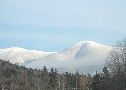
Mount Eisenhower
[1] Named after President Dwight D. Eisenhower, its summit offers a 360° view.
The Crawford Path, carrying the Appalachian Trail, crosses the mountain near its summit.
[4] It separates from the summit loop trail at 4,400 feet (1,300 m), 0.3 mi (0.5 km) south of the summit, and rejoins it 0.3 mi (0.5 km) northeast of the summit, having made a net elevation gain of about 40 feet (12 m) and reached a maximum on Eisenhower of about 4,520 feet (1,380 m).
[5] The shortest trail route to the summit of Eisenhower is from a parking lot on Mount Clinton Road, to its west-northwest, via primarily the Edmands Path.
All three of these peaks are included on the peak-bagging list of four-thousand footers in New Hampshire.