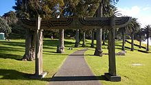
Mount Roskill
The name Mount Roskill was first recorded as Mt Rascal in 1841, on a map created by a Wesleyan missionary, referring to the volcanic peak Puketāpapa.
[7] The earlier eruption of Ōwairaka / Mount Albert and Puketāpapa blocked the original flow of the Oakley Creek, causing much of the area between the two peaks to become a peaty swamp.
It is surrounded by the neighbouring suburbs of Three Kings, Sandringham, Wesley, Hillsborough and Mount Albert.
[9] The Oakley Creek, traditionally known as Te Auaunga,[10] was a crayfish, eels and weka for Tāmaki Māori.
Harakeke (New Zealand flax) and raupō, which grew along the banks of the creek, were harvested here to create Māori traditional textiles.
[9][12] During the early 19th century, the focus of life for Ngāti Whātua was at Onehunga and Māngere,[13] and the Mount Roskill area was used seasonally.
[12] Mount Roskill formed a part of a land sale between Ngāti Whātua and the Crown on 29 June 1841.
[11] In 1845, Alexander Kennedy of the Union Bank of Australia, purchased much of the area from the Crown, on-selling this to Joseph May in 1849.
[11] The Crown sold further parcels of land to settlers in 1848 and 1849,[14] and the area developed into farmland by the late 19th century.
[16] The area was known to early settlers as a good location for raising ducks and geese, and as a source of water for cattle.
[15] In the early 1910s, Mount Roskill became known for its strawberry farms, primarily those operated by William Johnston and Teddy Edwards.
[15] During the 1920s, Chinese New Zealanders Quong Sing and Wong Key developed market gardens at Mount Roskill.
One of the earliest issues faced by the new borough was improving stormwater works for housing around the Oakley Creek, after substantial floods in Wesley in 1948 and 1953.
Keith Hay was the longest serving mayor of Mount Roskill, holding the role from 1953 until 1974, when Dick Fickling was elected.
[46] In 1970, Mt Roskill and Onehunga boroughs proposed merging into a single entity, however this merger never eventuated.
[45] On 1 November 2010, the Auckland Council was formed as a unitary authority governing the entire Auckland Region,[47] and Mount Roskill become a part of the Puketāpapa local board area, administered by the Puketāpapa Local Board.
The Puketāpapa local board area forms a part of the Albert-Eden-Puketāpapa ward, which votes for two members of the Auckland Council.