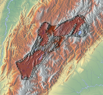
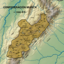
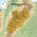
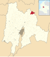
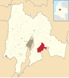
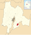
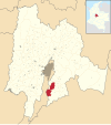
Muisca Confederation
[3] Modern anthropologists, such as Jorge Gamboa Mendoza, attribute the present-day knowledge about the confederation and its organization more to a reflection by Spanish chroniclers who predominantly wrote about it a century or more after the Muisca were conquered and proposed the idea of a loose collection of different people with slightly different languages and backgrounds.
Roads were present to connect the settlements with each other and with the surrounding indigenous groups, of which the Guane and Lache to the north, the Panche and Muzo to the west and Guayupe, Achagua and Tegua to the east were the most important.
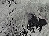
Multiple evidences of late Pleistocene to middle Holocene population of the Bogotá savanna, the high plateau in the Colombian Andes, have been found to date.
It is part of the Andean preceramic and ceramic, time equivalent of the North American pre-Columbian formative and classic stages and age dated by various archaeologists.
[11] Ample evidence of the Herrera Period has been uncovered on the Altiplano Cundiboyacense and main archaeologists contributing to the present knowledge about the Herrera Period are scholars Ana María Groot, Gonzalo Correal Urrego, Thomas van der Hammen, Carl Henrik Langebaek Rueda, Sylvia M. Broadbent, Marianne Cardale de Schrimpff and others.
According to the calendar they had specific times for sowing, harvest and the organisation of festivals where they sang, danced and played music and drank their national drink chicha in great quantities.
The most respected members of the community were mummified and the mummies were not buried, yet displayed in their temples, in natural locations such as caves and even carried on their backs during warfare to impress their enemies.
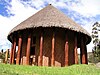
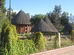
Their art is the most famous remnant of their culture, as living spaces, temples and other existing structures have been destroyed by the Spanish who colonised the Muisca territories.
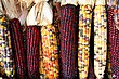
To diversify their diet, they traded mantles, gold, emeralds and salt for fruits, vegetables, coca, yopo and cotton cultivated in lower altitude warmer terrains populated by their neighbours, the Muzo, Panche, Yarigui, Guane, Guayupe, Achagua, Tegua, Lache, Sutagao and U'wa.
Trade of products grown farther away happened with the Calima, Pijao and Caribbean coastal communities around the Sierra Nevada de Santa Marta.
The Muisca economy was self-sufficient regarding the basic supplies,[clarification needed] thanks to the advanced technologies of the agriculture on raised terraces by the people.
The system of trade was well established providing both the higher social classes and the general population abundances of gold, feathers, marine snails, coca, yopo and other luxury goods.
The Muisca used two forms to express twenty: "foot ten"; quihícha ubchihica or their exclusive word gueta, derived from gue, which means "house".
The Muisca were a highly religious people with their own beliefs on the origin of the Earth and life and human sacrifices were no exception to please the gods for good harvests and prosperity.
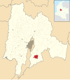
It became known with the Spanish conquerors as the site of El Dorado where the new zipa was covered in gold dust and installed as the new ruler of the southern Muisca.
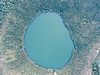
[25] According to Muisca myths, the Tequendama Falls, outside Soacha, was the site where the first zipa Meicuchuca lost his lover who turned in a snake and disappeared in the waters of the Bogotá River.
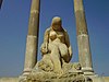
[26][27] El Infiernito, close to the present town of Villa de Leyva was a sacred site where the Muisca erected structures based on astronomical parameters.
[35][36][37][38][39][40][41][42][43][44] A delegation of more than 900 men left the tropical city of Santa Marta and went on a harsh expedition through the heartlands of Colombia in search of El Dorado and the civilisation that produced all this precious gold.
The first phase of the conquest was ended by the victory of the few conquistadors left over Tisquesusa, the last zipa of Bacatá, who fell and died after the battle at Funza, on the Bogotá savanna, April 20, 1537.
[45] When Tisquesusa was informed of the advancing invasion of the Spanish soldiers, he sent a spy to Suesca to find out more about their army strength, weapons and with how many warriors they could be beaten.
The zipa left the capital Bacatá and took shelter in Nemocón which directed the Spanish troops to there, during this march attacked by more than 600 Muisca warriors.
[46] When Tisquesusa retreated in his fort in Cajicá he allegedly told his men he would not be able to combat against the strong Spanish army in possession of weapons that produced "thunder and lightning".
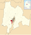
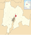
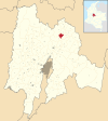
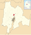
[40] Passing through Suba, Chía, Cajicá, Tocancipá, Gachancipá, Guatavita and Sesquilé, he arrived in Chocontá, founding the modern town on June 9.
The rich mineral resources of the Altiplano had to be extracted, the agriculture was quickly reformed, a system of encomiendas was installed and a main concern of the Spanish was the evangelisation of the Muisca.
[81] The second bishop of Santafé, Luis Zapata de Cárdenas, intensified the aggressive policies against the Muisca religion and the burnings of their sacred sites.