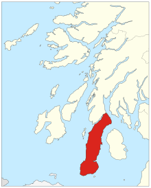
Mull of Kintyre
From here, the Antrim coast of Northern Ireland is visible on a calm and clear day, and a historic lighthouse, the second commissioned in Scotland, guides shipping in the intervening North Channel.
[1][2] The geographical reference is to a land formation bare of trees, such as a rounded hill, summit, mountain, promontory, or headland.
On clearer days it is also possible to make out Malin Head in Inishowen in County Donegal in the north of Ulster, and the Ayrshire coast on the other side of Ailsa Craig.
Notoriously strong currents plague the tip of the Kintyre Peninsula creating a hazard to unmotorised craft and virtually impossible for distance swimmers.
[10] According to the myth, the BBFC would not permit the general release of a film or video if it depicted a phallus erect to the point that the angle it made from the vertical was higher than that of the Kintyre peninsula, Argyll and Bute, on maps of Scotland.