Parys Mountain
Originally known as Trysclwyn, the high ground is reputed to have gained its current name when it was given to Robert Parys, Chamberlain of North Wales by Henry IV.
[2] The 18th century miners recognised that they were following in the steps of much earlier workers, an observation that was then linked to the discovery locally of copper ingots bearing Roman inscriptions.
[3][1] In 1764, Charles Roe of Macclesfield approached Sir Nicholas Bayly wanting to lease the copper mine at Penrhyn du, on the Llŷn Peninsula.
[3] However a last-ditch attempt was successful when their agent, Rowland Pugh, a local miner, discovered the "Great Lode" on 2 March 1768 and was rewarded with a bottle of whisky and a rent-free house for his lifetime.
[3] A further discovery of ore was made in 1775 further to the West of "the Great Lode" by The Reverend Edward Hughes, who was co-owner of that area with Sir Nicholas Bayly, and to exploit this he formed the Parys Mine Company that same year.
[4] The 21 year lease of Charles Roe expired in 1785, and so the Earl of Uxbridge (who had succeeded Sir Nicholas Bayly), decided to form the Mona Mine Company.
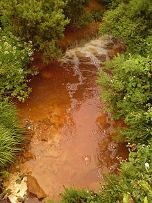
[8] The copper from the mine was used to sheath the British Admiralty's wooden ships of war, to prevent the growth of seaweed and barnacles and to protect the wood from attack by shipworms.
This increased the speed and manoeuvrability of the vessels, and enabled them to remain at sea for longer as there was less need to return to port for maintenance (see Copper sheathing for further details).
The processes were described by the German writer and translator Augustin Gottfried Ludwig Lentin (1764–1823), who visited Parys Mountain in the 1790s and published his findings in Briefe über die Insel Anglesea: vorzüglich über das dasige Kupfer-Bergwerk und die dazu gehörigen Schmelzwerke und Fabriken (Leipzig: Crusius, 1800).In response to a national shortage of small currency, the Parys Mine Company produced its own coinage between 1787 and 1793.
This operation of the precipitation pits appears to have ceased around 1940, and in the 1990s it was realised that the large volume of water held back by a decaying dam and inoperative valves posed a flood risk.
[11] This operation dropped the water levels by 70 metres (230 ft), and gave access to many more passages and to a connection to the nearby previously inaccessible Mona Mine.
[15] Drilling to better define the Northern Copper Zone started in late 2023, with the target of improving the confidence of the mineral estimates for inclusion in the feasibility study, and explore adjacent areas as yet undrilled.