Nacotchtank
[3] This was due to close association and tribute with the nearby Piscataway chiefdom, whose tayac (grand chief) ruled over a loose confederacy of tribes in Southern Maryland from the village of Moyaone to the south.
[7] Various pieces of art and other cultural artifacts, including hair combs, pendants, pottery, and dog bones, have been found in excavations throughout Washington, D.C., on Nacotchtank territory.
[11] The tribe's physical location, which had a mild, temperate climate in the mid-Atlantic, allowed for the Nacotchtank to become a flourishing, self-sustainable community with an abundance in myriad natural resources.
[6] The Nacotchtank were also accomplished in agricultural practices, as they would move inland from the rivers to occupy fertile and flat land and grow a variety of crop species, most of which belonged to the Three Sisters family—corn, beans, and squash.
[13] Since the Nacotchtank had abundant natural resources and were situated where two rivers met, they held an epicenter for a bustling trade network with neighboring tribes.
[14] The Nacotchtank were first recorded by Captain John Smith, who visited their palisaded village during his First Voyage in 1608, in which he explored the land surrounding the Jamestown settlement of the Colony of Virginia.
[15] Between the dates of June 16 and July 18 of 1608, Smith recorded in his journal, which has since been published as The Generall Historie of Virginia, New-England, and the Summer Isles, his impressions of the indigenous peoples of the Potomac River.
[5] In the year 1621, Captain Henry Fleet, age 20, took a party of approximately 26 settlers from Jamestown in an attempt to barter for corn from the Nacotchtank.
[19] The Patawomeke, an Algonquian-speaking people, were established across from the Nacotchtank along the Potomac River, within what are now Stafford and King George counties of Northern Virginia.
"[21] As such, the Patawomeck chief not only allied with the colonists, but also helped them in avenging the death of Fleet's party and in attaining corn by providing roughly 40-50 warriors to take part in a raid against the Nacotchtank.
[22] As a result of the raid, a mixed colonial and Patawomeke force killed 18 Nacotchtank people and drove the rest from their cabins before plundering and burning the village.
[23] When the Jesuits arrived in Maryland in 1634, who wanted to adapt church teachings for the natives, Fleet helped by translating the Algonquian language used by the Nacotchtank to English, under the guidance of Governor Leonard Calvert.
[5] In 1663, Cecil Calvert, the second Lord of Baltimore, granted Thomas Dent an 850-acre tract of land named Gisborough on the Potomac River, which bordered the principal Nacotchtank village.
[5] Additionally, with the two groups now close to one another and in constant contact, the Europeans from Maryland introduced to the area a number of Eurasian infectious diseases to which the Nacotchtank had no immunity, such as measles, cholera, and smallpox.
[28] With the increased sense of tolerance of indigenous peoples in Pennsylvania, the Piscataway, which the Nacotchtank coalesced with, migrated north and settled on land bordering the lower Susquehanna River around the year 1700.
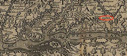
[5] The Nacotchtank's principal village, Nachatank, was situated along the eastern bank of the Potomac River on the land of what is now the Bolling Air Force Base.
[8] Proudfit studied the excavation that was performed when the swimming pool was being constructed in the White House, which is relatively inland from any of the Nacotchtank river settlements.
"[37] This theory of pottery as a marker for permanent occupation was used in Proudfit's mapping of another Nacotchtank village north of Garfield Park on what is now Capitol Hill.
[8][38] The Nacotchtank settled on this specific area as it was flat and much more suitable for agriculture than the uneven land bordering the rivers on which they were initially established.
[45] At these quarries, the Nacotchtank would chip away large chunks of the rock, which would then be taken back to the individual villages, where they would complete formation of whatever artifact they were intending to create.
[45] Quartzite, which was relatively-easily chipped and available in a quarry in the Piney Branch area of what is now Northwest Washington, D.C., was used in forming sharp-edged tools, particularly spears and arrow points.