Ness Ziona
[2] Lying within Ness Ziona's city bounds is the ruin of the Arab village of Sarafand al-Kharab, which was depopulated in 1948.
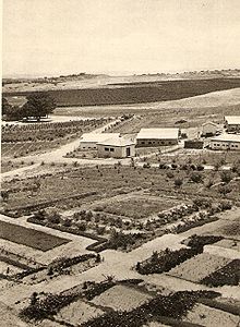
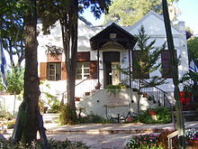
[6][7] In 1878, the German Templer Gustav Reisler purchased lands in Wadi Hunayn, planted an orchard, and lived there with his family.
He travelled to Odessa in 1882 and met Reuben Lehrer, born Patchornik (1832–1917),[8] a religiously observant Russian Jew with Zionist ideals, who had his own farmland there.
[9][10][11] Reuben Lehrer made aliyah (emigrated to Palestine) with his eldest son Moshe in 1883, bringing over his wife and another four of his children the following year.
[9][10][11] Lehrer placed advertisements near Jaffa port asking others to join him offering plots in his land for a small amount of money.
[10] The settlement (colony, moshava) was known for a while as Wadi Chanin after the local Arab village,[dubious – discuss] and as Nahalat Reuben (lit.
He gathered a group of people on the "Hill of Love"[clarification needed], where he arrived with the "Mahane Yehuda" mounted guards company he had founded,[13] and unfurled a blue and white flag emblazoned with the Star of David and the words "Ness Ziona" ('Banner toward Zion' or 'Miracle of Zion') written in gold.
[9][10] In 1905, the "Geula" organisation bought the piece of land separating the older Wadi Chanin/Nahalat Reuben and the newer Ness Ziona, allowing the two Jewish settlements to unite into one larger village.
In 1926, a new Arab village, Wadi Hunayn, developed across the Jaffa–Jerusalem road from a watermelon farm established there by the Abu Jaber clan from Sarafand el-Kharab, and became part of the same administrative unit as Ness Ziona.
The contract allowed the Electric Company to extend the grid beyond the original geographical limits that had been projected by the concession it was given.
The high-tension line that exceeded the limits of the original concession ran along some major towns and agricultural settlements, offering extended connections to the Jewish settlements of Rishon Le-Zion, Nes-Ziona and Rehovot (in spite of their proximity to the high-tension line, the Arab towns of Ramleh and Lydda remained unconnected).
Much of the territory abandoned by the fleeing Arab residents of nearby villages was added to Ness Ziona, increasing its size from 8 to 15.3 square kilometres (3.1 to 5.9 sq mi) immediately after the war.
[19] Ness Ziona is located on the Israeli coastal plain approximately 10 km (6 mi) inland of the Mediterranean Sea, to the south of Tel Aviv.
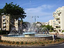
The city has been designed to have a rural character due to urban planning that bans the construction of buildings higher than eight stories.
After folding, they reformed as Ironi Ness Ziona in 2001, and since then have reverted to their former name and reached Liga Leumit, the second tier.