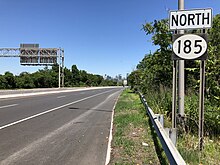
New Jersey Route 185
In reality, the freeway ends at Linden Avenue, and travelers must journey one city block west to Caven Point Road, which continues north to Liberty State Park.
The alignment would parallel Caven Point Road to the south and through the Metropolitan Tank Port before ending at Interchange 14B in Jersey City.
The alignment of the new arterial was proposed to be 2.75 miles (4.43 km) with four travel lanes (two in each direction) designed for hourly volume of 3090 vehicles.
The right-of-way for the new Liberty Harbor arterial would be 110 feet (34 m) wide and terminate at Interchange 14B, although there was the possibility of turning it into the new Hudson River Route, a project being studied by the New Jersey Department of Transportation (NJDOT).
Previous studies have said Route 185 could be extended, or the reverse with the Linden Avenue jog at Liberty State Park be removed.