New York City Subway chaining
Notable among these are several existing chaining lines that originated near New York City Hall via the Brooklyn Bridge, discontinued since 1944.
Exceptions exist to the principle that chaining numbers represent a railroad distance to the zero point.
[1]: 1 Sometimes trackage (usually but not always short distances) is chained backwards from a tie point with another line.
[1]: 1 The zeros were changed after the Far Rockaway station's opening, and are now at the railroad southernmost points of each division.
BMT A originally traversed the entire north side of the bridge, connecting Canal to DeKalb, while H ran towards Chambers St. instead of Canal, but this was reconfigured as part of the Chrystie Street Connection.
The tracks leading to Chambers St. were severed from the bridge and were re-designated as part of BMT J.
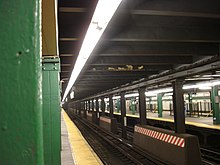
On engineering maps, the location of such features as curves, switches, crossings, stations and platforms are ordinarily specified to a precision of 1 foot (30 cm).
For greater precision, or where style or protocol requires it, unit of less than a foot may be described.
The Brooklyn Rapid Transit Company used [chains plus feet point hundredths] without trailing zeros: thus a map location designated as P.S.
In many locations a track may be going "railroad" north or south where the compass direction is different or even opposite.
These track numbers provide a definitive way of determining whether a particular direction on a particular line is going "railroad" north or south.
On most stations on the three-track IND Concourse Line, the chaining (from west to east) is:
Examples of all four tracks at a particular survey location (on the signal plate, the "-" is a line break):
An example of this was the Fulton Ferry branch of the Fulton Street Elevated (BMT K) which split from the Brooklyn Bridge branch at a location called Kings County (KC) Junction.
The stub end branch to Fulton Ferry (the original terminal) was chained backwards from Kings County Junction to the East River shoreline.
The chaining numbers went from 0+00 (zero) at the western end of Park Row station to 77+20 (7,720 feet) at KC Junction.
By this method, the distance from any point on the Fulton Street el to either terminal could be readily measured.
Many of these lines originally had individual chaining zero points as a result of the different companies that built and operated them.