New York State Route 26
It serves mostly rural areas for its first six miles (9.7 km) before entering a larger valley encompassing the Susquehanna River.
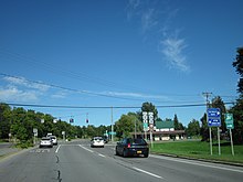
Here, the route widens to four lanes as it enters the densely populated town center of Vestal and connects to NY 434 by way of a partial cloverleaf interchange.
Past I-86, it continues over a bridge crossing the Susquehanna River and enters the village of Endicott on the north bank.
[5] The two routes overlap for several blocks through Endicott, following the two-lane Main Street westward through the village's central business district.
At Nanticoke Avenue, NY 26 turns to the north, following the street through the community's northern residential neighborhoods.
Outside of Endicott, the homes give way to significantly less developed areas as the highway runs through the Nanticoke Creek valley.
[5] In Lisle, Nanticoke Creek's east branch leads NY 26 into the Tioughnioga River valley, where the route connects to Interstate 81 (I-81) by way of a partial diamond interchange just outside the village of Whitney Point in the adjacent town of Triangle.
NY 26, meanwhile, follows the nearby Otselic River and its surrounding gully as it runs northeastward toward the Cortland County line.
Along the way, the highway runs along the east side of Whitney Point Reservoir and serves Dorchester Park, a recreation area overlooking the spillway.
From here, NY 26 runs generally northeastward to the hamlet of Taylor, where it turns to the east at a crossroad just north of the community's center.
[5] In Chenango County, NY 26 serves only a handful of isolated hamlets scattered across the undeveloped Otselic River valley.
[5] The overlap extends for 2.5 miles (4.0 km) into Madison County to the hamlet of Georgetown, where NY 80 forks to the northwest into a narrow creek valley.
While the river tapers off, NY 26 climbs slightly in elevation to wind its way northeastward around a series of mountains and hills.
The stream ends here, leaving the route to traverse another set of mountains to reach a low-lying, marshy area near Bouckville.
From here, NY 26 traverses more open farmland, crossing over the New York State Thruway in Westmoreland before entering the outer district of the city of Rome.
The route passes the Oneida and Mohawk correctional facilities just ahead of a junction with NY 365, a four-lane divided highway.
From West Leyden, the highway heads generally northeastward across another prolonged stretch of farmland, briefly entering the Constableville village limits and passing over the Sugar River on its way to an intersection with NY 12D.
The business and homes of Lowville lead to much less developed areas at the northern village line, and NY 26 traverses little more than open, rolling fields for the next five miles (8.0 km).
Just north of the Lowville town line in Denmark, the highway meets NY 410, a short connector serving the village of Castorland.
The highway immediately enters the village of West Carthage, where it briefly becomes concurrent with NY 126 through the sparsely populated western part of the community.
The route runs northwestward across the military reservation to the town of Le Ray, home to an intersection with US 11 just outside the Evans Mills village limits.
NY 26 joins US 11 here for the second time, following the Indian River northeast across generally rural areas to reach the village of Philadelphia.
At this point, NY 26 returns to a northwesterly alignment as it traverses rolling farmland for 6 miles (9.7 km) to access the village of Theresa.
The route turns north at this point, becoming concurrent with NY 37 for three miles (4.8 km) through a rural section of the town of Theresa.
[2] It began at the Pennsylvania state line south of Endicott[16] and went north to Carthage over its modern alignment.
From Oriskany Falls to Rome, it replaced NY 46,[2] which was moved onto a new alignment to the west that passed through the city of Oneida.
The first project completed in 2017, reconfigured the intersection with Oneida and Ontario avenues to improve safety and reduce congestion.
[33] Then on May 13, 2019, work began on the third $2.9 million project to reconstruct the intersection with US-11 near Fort Drum in Jefferson County.
The project provided additional turning lanes and added a slip ramp onto NY 26 for northbound traffic on US 11.