New York State Route 27
NY 27 acts as the primary east–west highway on southern Long Island east of the interchange with the Heckscher State Parkway in Islip Terrace.
The entire route in Suffolk, Nassau, and Queens counties were designated by the New York State Senate as the POW/MIA Memorial Highway.
Except for a short stretch in Great River, NY 27 has service roads that parallel the highway continuously from North Lindenhurst to Patchogue, and intermittently to the east into Southampton.
Near the junction with Ruby Street, NY 27 enters the borough of Queens, but retains the Linden Boulevard name.
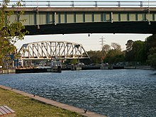
Sunrise became Conduit at 111th Street, which no longer exists, but is approximately where Aqueduct Road currently crosses over Route 27.
)[7][8] When the Nassau Expressway splits off, NY 27 continues east along Conduit Avenue and remains a frontage road for multiple exits of the Belt Parkway.
It heads east into Nassau County, passing through Valley Stream, Lynbrook, and Rockville Centre on its way to Merrick.
At the interchange with NY 109 in West Babylon, Sunrise Highway becomes a six-lane freeway with a two-lane service road on either side.
In East Patchogue, New York, the highway is reduced to a four-lane freeway after passing the NY 112 exit.
East of NY 24, Sunrise Highway crosses over the Shinnecock Canal and has one last eastbound exit before merging with CR 39.
NY 27 heads generally northeastward to East Hampton village where it becomes Woods Lane, and later, Main Street.
From East Patchogue to Brookhaven, NY 27 followed South Country Road, passing through the downtown section of the village of Bellport.
[11] On February 24, 1930, South Country Road was added to the Suffolk County highway system as CR 36.
Prior to 1970, NY 27A continued north to Canal Street in Manhattan by way of the Gowanus Expressway, the Brooklyn–Battery Tunnel, and the West Side Elevated Highway.
[26][27] Robert Moses developed plans for an elevated freeway featuring 10 to 12 lanes along Sunrise Highway through Nassau County.
This freeway would have provided a truck link for the South Shore of Long Island but the downtown villages along the route effectively put a stop to the idea.
The freeway portion of Sunrise Highway between North Lindenhurst and Shinnecock Hills was completed in full in 1998.
The Long Island Rail Road added three trains each way between Speonk and East Hampton during the construction.
For the most part, the road was to run a mile or two north of existing NY 27, thus avoiding the populated centers through which it now passes.
The original interchange with the Robert Moses Causeway in West Islip had two parkway-style arch bridges over two lanes of NY 27.
The interchanges at Fifth Ave and Brentwood Road in Bay Shore had parkway-style arch bridges and cloverleaves.
In the North Lindenhurst area, plans to construct a cloverleaf interchange with CR 2 (Straight Path) in Copiague have existed for some time.
To further complicate matters, a widened CR 28 was extended to Sunrise Highway near the Straight Path intersection in the late-1980s.
As recently as 1981, the New York State Department of Transportation planned to add service roads and a proper interchange at both ends of the merge.
NYSDOT eventually reconstructed Sunrise Highway in eastern Islip township into a freeway during the 1990s, resulting in the present configuration.
The entrance to Connetquot River Park remained as an at-grade intersection, accessible only from the westbound lane.
Former segments of Montauk Highway now exist on both sides of the interchange, and sections of both roads were converted into fishing areas owned by the New York State Department of Environmental Conservation.
[39] While none of the interchanges north of Patchogue were built until 1988 to 1993, the New York State Department of Transportation (NYSDOT) had known the need for them and had planned them decades before their eventual construction.
[citation needed] West of the Carmans River near Southaven County Park in South Haven, there was a plan to combine the eastbound service road with Montauk Highway, similar to the Oakdale Merge.