New York State Route 373
NY 373, located entirely within Adirondack Park, begins at US 9 at the Ausable Chasm, a deep, wooded canyon in the town of Chesterfield.
NY 373 continues farther along and intersects with County Route 71 (CR 71) before heading east-southeast just north of the Ausable River.
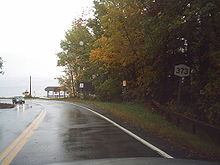
[3] The route then passes south of a golf course and enters Port Kent, where it intersects with more local streets, most of which serve homes and businesses.
[4] In 1823, a company was funded to establish a settlement and fishing wharf opposite the city of Burlington, Vermont on Lake Champlain in order to assist in the growth of iron factories and to supply dormant energy to the Essex County area.
The newly founded company chose the name "Port Kent" and located the new hamlet on a site north of Trembleau Point.
The original alignment of what is now NY 373 began as a wide road that was built to access Port Kent from the nearby village of Keeseville.
[6][7][8] On April 16, 1827, a team of three surveyors were commissioned to determine a routing for a new highway leading from Hopkinton, a town in northeastern St. Lawrence County, to Lake Champlain.
The commissioners believed that the change in the toll gate locations would result in higher revenue, allowing them to continue maintaining the highway.
[19] In the 1930 renumbering of state highways in New York, the entirety of the highway from Ausable Chasm to the Port Kent ferry landing was designated as NY 373,[2] despite the fact that the small portion of the route east of Lake Street in Port Kent was not maintained by the state at the time.