New York State Route 481
It enters Fulton as a four-lane surface road, but gradually narrows to two lanes as it heads through the northern portion of the city.
North of Fulton, NY 481 becomes a four-lane limited-access highway and proceeds to the outskirts of Oswego, where it reverts into a two-lane road.
Heading northwest from the I-81 interchange, the highway crosses U.S. Route 11 (US 11) almost immediately, passing just south of the former site of Penn-Can Mall.
The road soon enters the town of Clay, where it initially runs along the northern edge of a marsh for 3 miles (4.8 km).
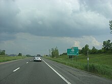
From here, the freeway heads through markedly less developed areas, running across farmland to reach the Oneida River (Erie Canal) at the northern edge of Onondaga County.
[6] As the route heads away from the village, it connects to NY 264 at a full diamond interchange about 1 mile (1.6 km) north of Phoenix.
As the route approaches the city limits, it takes on a more westerly track, passing over CSX's Fulton Subdivision and the Sunoco Ethanol plant located in the former Miller Brewing Company brewery[7] before intersecting CR 57 at an at-grade junction just inside the city limits.
Continuing into Volney, the highway briefly runs alongside the Oswego River prior to entering another lightly developed region of the county.
About 4 miles (6.4 km) north of Fulton, NY 481 expands to a four-lane divided highway once more; however, it remains an at-grade roadway.
The Fulton Subdivision also rejoins the road at this point, running alongside NY 481's northbound lanes to the Oswego city limits.
Between Fulton and Oswego, the route serves mostly undeveloped areas but has several stretches of scenic beauty, mostly consisting of glimpses of locks, rapids and small waterfalls through trees separating NY 481 from the river.
[6] NY 481 narrows to two lanes near the southern edge of Oswego, where it separates from the Fulton Subdivision and curves northwestward as it crosses into the city limits.