New York State Route 55
Together with NY 52, which it closely parallels and briefly joins in downtown Liberty, it forms the latitudinal backbone of the Hudson Valley region for non-interstate traffic.
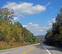
It offers the traveler a wide variety of landscapes, from farmlands, mountains and forests to the urban center of Poughkeepsie.
Sights along the way include two of New York City's major reservoirs in the Catskills, a dramatic crossing of the Shawangunk Ridge, and the Mid-Hudson Bridge.
NY 55 and CR 11 proceed northeast through the woods above the Delaware, reaching a small residential area near Old Brook Road.
The route soon becomes more wooded in nature, paralleling the western shore of the pond, and turns northwest past Sunrise Lake.
Passing the namesake body of water, NY 55 and CR 13 bend northeast and soon northward past numerous homes for several miles.
At this junction, NY 55 turns north onto CR 14, and the routes continue through White Lake as a two-lane residential road.
Paralleling the West Branch of the Mongaup River, NY 55 and CR 14 pass Woods, Pauls and Wheelers ponds before reaching the hamlet of Swan Lake.
The routes bend eastward past Kees Lake, passing some local residences before crossing into the town of Fallsburg.
Continuing eastward, the route reaches the southernmost point of the reservoir and a junction with CR 105 (Divine Corners Road), which connects to Loch Sheldrake.
Passing the Chestnut Creek Covered Bridge nearby, NY 55 quickly leaves Curry and bends southeast through the hamlet of Unionville.
Paralleling the widest points of the reservoir, the route makes a gradual bend to the northeast, leaving the Catskill Forest Preserve.
Winding northeast, US 209 and NY 55 pass multiple residential areas before reaching a more rural section of the town, paralleling Rondout Creek eastward into the hamlet of Kerhonkson.
Continuing south away from the Shawangunks, the routes cross North Mountain Road and make a bend to the southeast, reaching a junction with CR 7 at the hamlet of Benton Corners.
After Benton Corners, US 44 and NY 55 continue southeast through the town of Gardiner, reaching the hamlet of Tuthilltown and a junction with CR 9.
[4] Paralleling the Shawangunk Kill, US 44 and NY 55 soon reach the Wallkill River and cross it into the small hamlet of Tuthill.
[4] Leaving Modena, US 44 and NY 55 turn northeast through Plattekill, passing multiple residences and cross under the New York State Thruway (I-87).
Passing numerous farms west of Clintondale, US 44 and NY 55 cross a junction with CR 22 (South Street) and through the residential hamlet.
[4] The routes soon cross back into the town of Plattekill, passing multiple residences along an eastward stretch near the Pancake Hollow Brook.
Crossing past several ponds, CR 15 forks off again at the junction with Pancake Hollow Road before US 44 and NY 55 reach the hamlet of Baileys Gap.
Several blocks eastward, the routes soon cross a junction with NY 376 (Raymond Avenue), which terminates just to the north at the westbound lanes.
NY 55 continues winding eastward through LaGrange, beginning to become more rural, reaching a junction with the southern terminus of CR 47 (Freedom Road).
The route soon crosses over Sprout Creek and becomes a two-lane commercial/rural road through LaGrange, reaching the hamlet of Billings, where it junctions with NY 82.
[4] NY 55 continues southeast through Beekman, crossing through the rural sections of Dutchess County, soon reaching the hamlet of Poughquag.
Through Poughquag, the route is mainly residential, soon bending southward then southeast along Whaley Lake Stream into a junction with the eastern terminus of NY 216.
[4] Now in Pawling, NY 55 continues southeast on a parallel of the Housatonic Railroad and the Whaley Lake Stream, bypassing the hamlet of Woodinville.
The route then crosses over the East Branch of the Croton River and the Metro-North Railroad Harlem Line, passing south of the Pawling station, which is connected via CR 69.
Along the eastern stretch, NY 55 crosses through the dense woods of Webatuck and pass a junction with the southern terminus of CR 22 (Dogtail Corners Road).
[20][21] Both changes were made in order to accommodate the Rondout Reservoir, which was created c. 1950 following the construction of the Merriman Dam.
[22][23] The steel truss bridge located near the eastern side of the Rondout Reservoir and the junction with NY 55A was rehabilitated in 2010.