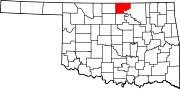
Newkirk, Oklahoma
The Cherokee acquiesced to the demand of the president and Department of the Interior to sell the land, then part of Oklahoma Territory, to the U.S. government.
[8] Two miles north of Lamoreaux was Kirk, a Santa Fe Railroad cattle-shipping station.
Young Elms, Cottonwoods, shrubs, and flowers began to change the once treeless prairies into shaded garden spots.
[12] After Oklahoma became a state in 1907, Newkirk, Blackwell, and Ponca City vied to become the county seat.
[9] The present Kay County courthouse was built in 1926, replacing the original 1894 wooden structure that had burned.
[14] According to the United States Census Bureau, the city has an area of 1.3 square miles (3.4 km2), all land.
Newkirk is on mostly flat terrain with no large watercourses nearby, and at the boundary between two ecoregions: the Central Great Plains and the Flint Hills.
West of the town on the Great Plains, the countryside is rich agricultural land, especially for wheat, soybeans, and cattle.
East of town, the Flint Hills' terrain is more rugged and rocky and is primarily used for cattle ranching.
Natural vegetation is mostly prairie, but stream valleys often have forests of cottonwood, oak, elm, ash, pecan, sycamore, and other species.
Wildlife is abundant, including whitetail deer, turkey, bobwhite quail, coyote, bobcat, and waterfowl.
A casino and other facilities owned by the Kaw Indian tribe are 1 mile (1.6 km) east.
Near the river are the Deer Creek/Bryson Paddock sites, where archeologists excavated the ruins of two prominent 18th-century Wichita Indian villages.
Beyond the river, continuing east, is the lightly populated, tallgrass prairie region with many large ranches.