Nez Perce County, Idaho
[2] The county is named after the Native American Nez Perce tribe.
Nez Perce County is part of the Lewiston, Idaho–WA Metropolitan Statistical Area.
Nez Perce County was originally organized in 1861, when the area was part of Washington Territory.
Rapid migration to the Palouse in the 1880s led to the formation of Latah County in 1888.
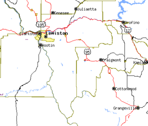
[5] Nez Perce County has two rivers, the Clearwater and the Snake, which meet in Lewiston and then flow west.
The Clearwater flows from the east and the Snake from the south, creating the state border with Washington (and further upstream, Oregon).
The northern portion of the county is part of the Palouse, a wide and rolling agricultural region of the middle Columbia basin.
Nez Perce County is currently strongly Republican, though less so than southern Idaho: it is one of only nine counties (out of 44) in Idaho that has failed to vote Republican in every presidential election since 1968,[6] and indeed supported Michael Dukakis and Bill Clinton (by plurality) three times in succession from 1988 to 1996.
In 2004 Republican George W. Bush defeated Democrat John Kerry 62% to 36%.
As of the 2010 United States Census, there were 39,265 people, 16,241 households, and 10,331 families living in the county.