Nico Ditch
Nico Ditch is a six-mile (9.7 km) long linear earthwork between Ashton-under-Lyne and Stretford in Greater Manchester, England.
The earliest documented reference to the ditch is in a charter detailing the granting of land in Audenshaw to the monks of the Kersal Cell.
It may have been derived from the Anglo-Saxon Hnickar, a water spirit who seized and drowned unwary travellers, but the modern name is most likely a corruption of the name Mykelldiche and its variations; this is because the Anglo-Saxon word micel means "big" or "great", harking back to the early 13th century description of the ditch as magnum fossatum.
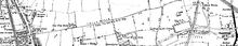
[3] It passes through Denton, Reddish, Gorton, Levenshulme, Burnage, Rusholme, Platt Fields Park in Fallowfield, Withington and Chorlton-cum-Hardy, crossing four metropolitan boroughs of present-day Greater Manchester.
[5] In the early medieval period, the Anglo-Saxon kingdoms of Northumbria, Mercia, and Wessex struggled for control over North West England,[6] along with the Britons and the Danes.
[8] It was said that each man had an allocated area to construct, and was required to dig his section of the ditch and build a bank equal to his own height.
Between 1990 and 1997, the University of Manchester Archaeological Unit excavated sections of the ditch in Denton, Reddish, Levenshulme, and Platt Fields, in an attempt to determine its age and purpose.