Norman Park, Queensland
[citation needed] Norman Park State School opened on 9 July 1900 with 52 students with a principal and three teacher.
[7][8] Between 1912 and 1926, a steam tram service to Belmont connected with the Queensland Government Railway at Norman Park.
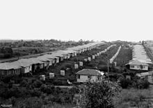
[citation needed] A major subdivision of 364 housing lots occurred in 1922 of the land formally owned by Louis Hope, however Norman Park remained a largely rural area until after World War II, when rapid development took place as the result of the construction of public housing.
87.4% of people only spoke English at home, while the next most commonly spoken languages were Greek (0.8%), German (0.6%), French (0.5%), Italian (0.5%), and Japanese (0.4%).
This corridor is also serviced by two alternating express bus routes between the Brisbane central business district and Cannon Hill Shopping Centre bus station and eastern suburbs, observing Norman Park and Norman Park North express stops.
The Stanley Street East-Milsom Street-McIlwraith Avenue corridor in the suburb's south is serviced by one all-stops route that travels between the Brisbane central business district and Cannon Hill Shopping Centre bus station.
[citation needed] The Cleveland railway line passes through the suburb, with Norman Park station located centrally.
[citation needed] Norman Park Ferry Terminal is located off Wynnum Road in the suburb's north.
The cross-river ferry service was ended in 2020 by the Brisbane City Council due to low passenger numbers.
[33] Despite the suburb being well serviced by three modes of public transport, no formal coordination exists between them aside from the Translink fare structure and relatively high frequency standards.
The suburb is situated within Translink Zone 2, which makes it attractive to city commuters with respect to relatively cost-effective transit travel.
[citation needed] The hilly terrain in the suburb's north and east sides, busy traffic conditions and bisection by the Cleveland railway line also impose some impediment to local walking opportunities.
However, the semi-grid structure of the road and street network and the presence of urban borders (verges) on almost all roadways promote relatively direct and safe walking conditions.
The major roads contain numerous signalised intersections with pedestrian control, which are typically located adjacent to bus stops.
Seven Hills Bushland Reserve is also located within walking distance of the eastern side of Norman Park.