Nudgee Beach, Queensland
[1] The suburb is 17.9 kilometres (11 mi) north-west of the Brisbane central business district.
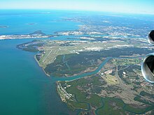
The suburb is bounded to the north-east by Moreton Bay, to the south-west by Kedron Brook (27°22′23″S 153°06′23″E / 27.3731°S 153.1065°E / -27.3731; 153.1065 (Kedron Brook)), to the south-west by the Gateway Motorway, and to the north-west by Nundah Creek (27°20′09″S 153°05′01″E / 27.3357°S 153.0836°E / -27.3357; 153.0836 (Nundah Creek)).
[5] There is a Brisbane City Council waste transfer station (known by the council as a resource recovery centre) in the south of the locality (27°21′40″S 153°06′01″E / 27.3612°S 153.1003°E / -27.3612; 153.1003 (Nudgee Beach Resource Recovery Centre)).
[5] There is a network of bike tracks which connect through to Toombul shopping centre.
77.9% of people living in Nudgee Beach were born in Australia, compared to the national average of 69.8%; the next most common countries of birth were England 4.6%, New Zealand 4.2%, Ireland 2.7%, Germany 1.1%, Papua New Guinea 1.1%.
The nearest primary and secondary school is Earnshaw State College in Banyo.