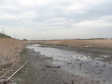
Obitsu River
The Obitsu emerges from the densely forested valleys around Mount Motokiyosumi (344 meters (1,129 ft)) in the Bōsō Hill Range[1] and empties into Tokyo Bay.
[2] The Koito River, similarly to the Obitsu, emerges from Mount Motokiyosumi, flows east across Bōsō Peninsula, and empties into Tokyo Bay.
The shogunate excavated and straightened the meandering middle part of the Obitsu River to develop new paddy fields[1] for the cultivation of rice and renkon lotus root.
Rice, as the nengu tax tribute to the Tokugawa shogunate, passed from the former Kururi Region of Kimitsu to the port at Kisarazu, typically crossing a distance of 27.5 square kilometers (10.6 sq mi).
[17] The mouth of the Obitsu River became a lively trade center, as the Port of Kisarazu had exclusive rights to sea traffic between the western Bōsō Peninsula and the Edo capital.
Despite the large industrial development of the lower part of Obitsu River, the middle and upper ranges of the continue to be used extensively for rice and vegetable production.