Ogemaw Hills Pathway
The Pathway offers approximately 15 miles of trails open to hiking, cross country skiing, and biking.
The Ogemaw Hills Pathway trail system traverses a well defined ridge of hills north of West Branch, Michigan referred to by geologists as the West Branch Moraine, a recessional moraine outwash formed by the Saginaw Lobe of the Laurentide Ice Sheet.
A fifty-foot steel fire lookout tower was constructed in the fall of 1914 and the footings are still visible.
Many clearings within the Ogemaw Hills Pathway trail system are old farm fields being reclaimed by the forest and fence lines, rock piles, and foundations can be found.
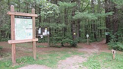
The trail system features a well defined trail-tread and is blazed by blue triangle markers.