Olching
Olching (Central Bavarian: Oiching) is a town in the district of Fürstenfeldbruck, and suburb to Munich in Bavaria, Germany.
These new developments, especially Schwaigfeld, located north-east of the town centre — close to Olching's motorway exit — have attracted controversy amongst some locals for their apparently inconsistent planning and sometimes eclectic architecture.
Olching is bordered to the west by Gernlinden, and Maisach; in the north, Bergkirchen; in the East from Gröbenzell and the outskirts of metropolitan Munich and to the south by Puchheim, Eichenau, Emmering and Fürstenfeldbruck.
The line is part of the MVV, or Münchener Verkerhrsverbund, which is a unified tariff zone that includes local buses, trams, and underground trains (U-Bahnen) in the Munich area.
Other significant factors affecting the weather are the Alps, which act as south-central European border, and the Danube, which is a regional meteorological divide.
The so-called foehn is a weather phenomenon particular to the region near to the Alps that occasionally brings warmer and drier air from the south to Olching, potentially occurring at any time of year.
In 740 the Agilolfingian duke Tassilo II of Bavaria bestowed the town, together with its church and flour mill, to the Benediktbeuern Abbey (the authenticity of this document is contested).
In 1258 Louis II, Duke of Bavaria founded a monastery as a form of penance for the execution of his wife Maria von Brabant, who had wrongfully been convicted of adultery.
Olching suffered severely as a consequence of the Thirty Years' War, particularly after the city of Munich was taken by Gustavus Adolphus of Sweden in 1632.
During an allied air raid on 22 February 1944, 22 people were killed, including two of the approximately 1000 forced laborers located in and around Olching during the war.
In 1978 Esting, Geiselbullach, and Graßlfing were merged into the larger community of Olching and this has contributed towards a continuous population growth, especially since the development of the Schwaigfeld area in the early 2000s.
The swept blue bar in the lower part symbolises the river Amper, which flows through Olching and is of major significance for the town.
The reed in the middle reminds that Olching was once marshland; the head of wheat symbolises the agriculture and land cultivation.
Right next to the Schuttberg is the Volksfestplatz, (a fairground), a site which acts in the off-season as a cycle practice range, incorporates a go-kart training area, has a small skate-park and hosts monthly flea-markets throughout the summer.
Located at the western end of the Hauptstrasse, its various intimate rooms are used for exhibitions, chamber and classical music performances, and seminars and meetings by various Olching clubs.
The carnival parade (Faschingsumzug) takes place annually on Shrove Tuesday at 2:00 pm and has a long tradition in Olching.
This is done to dispose of superfluous wood (including remaining Christmas trees) while earning donations for local charitable groups and organizations.
The fair consists of rides, stalls, food and entertainment, and a large beer tent, which are set up on the Volksfestplatz (fairground).
The community organises a broad range of events during the festival, including a popular large firework display, usually on the first Monday of the fair.

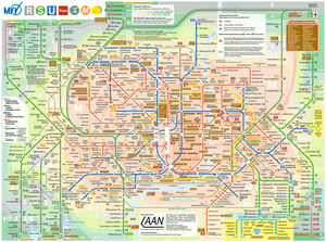
 suburban train line that connects to Olching.


