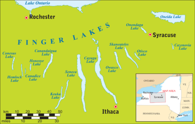
Oneida Lake
From the earliest times until the opening of the Erie Canal in 1825, the lake was part of an important waterway connecting the Atlantic seaboard of North America to the continental interior.
[4] During the 18th and early 19th centuries Oneida Lake and its tributary Wood Creek were part of the Albany-Oswego waterway from the Atlantic seaboard westward via the Hudson River and through the Appalachian Mountains via the Mohawk River; travel westward then was by portage over the Oneida Carry to the Wood Creek-Oneida Lake system.
Following the American Revolutionary War, the United States forced the Iroquois nations to cede most of their lands in that region, as most of them had allied with the British, who were defeated.
[5] Even more significant was the completion in 1825 of the Erie Canal, which bypassed the Oneida Lake system and enhanced travel through the entire Mohawk Valley.
The new barges were powered internally (by diesel or steam engines), so they could travel open water and against a current; the system no longer needed infrastructure for drawing vessels externally — i.e., drawpaths and draft animals.
New terminal walls at Sylvan Beach, Cleveland, and Brewerton allowed barges to load and unload cargo and to stay overnight.
[citation needed] These improvements provided towns along the shoreline of Oneida Lake with access again to navigable waterways east and west.