OpenSeaMap
OpenSeaMap is part of the OpenStreetMap database, and complements the spatial data with nautical information.
This ensures integration into printed materials, websites and applications is possible, without being limited by restrictive licenses, or having to pay fees.
The idea for the project was born at an OpenStreetMap developer conference in autumn 2008 at the Linux Hotel in Essen, Germany.
A group of boaters and programmers decided to extend the coverage of OpenStreetMap to the seas and fresh water bodies.
In January 2010, OpenSeaMap was given a booth at boot Düsseldorf, Europe's largest boat show, allowing volunteers to present the project to a large audience of specialists for the first time.
Charts will show lighthouses, lateral buoy, cardinal marks and other navigational aids.
Similarly, public authorities, shipbuilders and repairers, as well as sanitation and utility facilities will be displayed.
[2] OpenSeaMap includes additional layers such as aids to navigation, ports and temporary racing events.
The site is translated into six languages: English, German, French, Italian, Spanish and Russian.
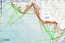
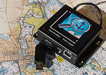
Sailors, motor boaters, divers, and fishermen can collect water depths between 0 and 100 m with sounder tools and GPS.
By "View Wikipedia-Links" OpenSeaMap displays all georeferenced Wikipedia articles worldwide as Icon, and optionally as gallery of all pictures from Commons.