Orinoco Basin
From the combination of these two forces that modify the relief, a constructive one, the sedimentation and another destructive one, the erosion, arises the current situation in which the river marks approximately the limit between the two regions.
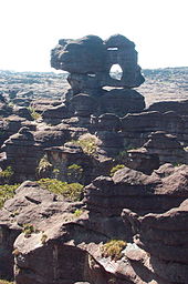
As can be seen from the above, this limit presents exceptions since, in some sections, rounded hills of granite origin (and therefore, Guayan reliefs) can be seen on the left bank of the Orinoco, that is, on the border of the Llanos.
Moreover, were it not for the fact that the Guayanese Massif has been suffering a slow and long movement of ascent, in the present time it would have already become a penillanura in which almost all the sedimentary cover of sandstones would have disappeared.
And these sands could become over millions of years in strata of sandstones that could also become converted to rise and rejuvenate the relief on plateaus similar to those that now exist in Guyana.
A spatial image (also known as the Atlas of PDVSA,[6] of a paleodunas eco-system formed in an environment with a climate much drier than the present one, but of a mechanism of formation of dunes that only acts during the dry season since.
When the level of the waters of the Orinoco falls due to the drought of the rivers, especially those that come from the Llanos, they remain extensive beaches of very fine sand, that the trade winds soon transfer towards the south-east forming what now constitutes the Santos Luzardo National Park, a name taken from one of the main characters in Doña Bárbara's novel by Rómulo Gallegos.
The basis for the establishment of houses, herds and roads, and this process becomes more noticeable to the west, not only by the decrease of the speed of the winds as they move in that direction but also because the sands they form.
At higher altitudes four or five thermal, climatic, biotic or ecological floors can be distinguished according to criteria used by different authors and their interest in their field of research.
However, Ciudad Bolívar's climate is not representative of the entire Orinoco basin, but is rather an anomaly, in the sense that, because of its location with respect to the prevailing winds (by the action of mountains north-eastern Venezuela and the plateaus of the south-east) and this city being somewhat distant from the sea (the influence of the rainfall of the coastal drift in the Venezuelan Atlantic coasts), the precipitations are quite smaller than they should be.
There are numerous islands, both rocky (erosion reliefs) and sedimentary (sand and other sediments), as well as many pipes or arms, abandoned meanders and horseshoe lakes.
On the left bank we can mention the Mavaca, the unique case in the Casiquiare world (which is not a tributary but, on the contrary, an effluent, that is to say, a derivation of the Orinoco that drains its waters towards the Amazon basin through the Negro River), the Atabapo, the four rivers that come from the Colombian territory, which are the Guaviare (with its tributary the Inírida), Vichada, Tomo and Meta.
In the Guayana part of the Orinoco basin, the equatorial forests predominate, characterized by the existence of several levels of trees of very varied species, as a consequence of a high competition to obtain a sufficient supply of solar rays.
When they overcome the roof and increase the function of photosynthesis they begin to grow strangling the tree on which they had leaned (as well as blocking the sunlight).
The other distinguishing note is the enormous annual biomass production: about 500 t/yr/ha, against about 300 in the coniferous forests of the Taiga area in the northern hemisphere, under the most favorable conditions.
But for millions of years (since the primary era, when the first plant species appeared on our planet) has accumulated an enormous amount of biomass on the earth's surface (and also in the subsoil as hydrocarbons), where it usually there is a close correspondence between production and consumption that fluctuates over time in a process of equilibrium.
This means that, as a whole, the balance between production and consumption, both oxygen and carbon dioxide, follows an eternal process of feedback that is responsible for reaching at a given moment a situation of climax, a concept that will need, with time, be revised.
Of course, this does not mean that the geographic environment (soil, vegetation, fauna, pollutant production) can continue to be depleted without restrictions until reaching irreversible situations.
What has to be taken into account is that the capacity of regeneration and restoration of the balance lost in the vegetation of the inter-tropical zone, on the one hand, is much greater than what people (including scientists) assume and on the other hand that, in parallel with the processes of desertification due to the poor management of the environment and the depletion of many natural resources, there is a continuous advance in the use and rescue for reforestation and for the cultivation of previously uncultivated and unproductive areas that have giving rise to overproduction in many orders with regard to food, especially in the intertropical zone.
The drink known as Amargo de Angostura, for example, is an example of the development of a tonic developed in the Angostura of the Orinoco (now Ciudad Bolivar) that was very useful since the nineteenth century because, although with a composition created by Johann Gottlieb Benjamin Siegert, and which has always been kept in the greatest secrecy until today, is known to contain among its ingredients quina (hence the bitter taste) and sarrapia, vegetables whose medicinal principles have been perfectly proven for more than three centuries.