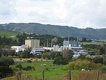
Maungaturoto
Maungaturoto is a small town in the Northland Region of New Zealand.
The township is located close to the Otamatea River, an estuarial arm of the Kaipara Harbour 25 kilometres north of Wellsford and 45 kilometres south of Whangārei.
The New Zealand Ministry for Culture and Heritage gives a translation of "mountain standing up in lagoons" for Maungatūroto.
[3] Statistics New Zealand describes Maungatūroto as a rural settlement, which covers 3.17 km2 (1.22 sq mi)[1] and had an estimated population of 1,050 as of June 2024,[2] with a population density of 331 people per km2.
The results were 82.7% European (Pākehā); 29.0% Māori; 4.2% Pasifika; 3.3% Asian; 0.7% Middle Eastern, Latin American and African New Zealanders (MELAA); and 3.9% other, which includes people giving their ethnicity as "New Zealander".
The percentage of people born overseas was 13.7, compared with 28.8% nationally.
Of those at least 15 years old, 60 (8.3%) people had a bachelor's or higher degree, 411 (57.1%) had a post-high school certificate or diploma, and 222 (30.8%) people exclusively held high school qualifications.
The results were 84.4% European (Pākehā); 26.8% Māori; 3.9% Pasifika; 3.0% Asian; 0.5% Middle Eastern, Latin American and African New Zealanders (MELAA); and 3.0% other, which includes people giving their ethnicity as "New Zealander".
The percentage of people born overseas was 13.3, compared with 28.8% nationally.
Of those at least 15 years old, 84 (8.1%) people had a bachelor's or higher degree, 615 (59.2%) had a post-high school certificate or diploma, and 312 (30.1%) people exclusively held high school qualifications.
[20] About 2 km (1.2 mi) south west of the town,[21] Maungaturoto had a station on the North Auckland Line from 13 August 1915 to 12 June 1987.