Otley
Otley is a market town and civil parish at a bridging point on the River Wharfe, in the City of Leeds metropolitan borough in West Yorkshire, England.
[2][3] The name Chevin has close parallels to the early Brythonic Welsh term Cefn meaning ridge and may be a survival of the ancient Cumbric language.
[4] There are pre-historic settlement finds alongside both sides of the River Wharfe and it is believed the valley has been settled at this site since the Bronze Age.
[5] West Yorkshire Geology Trust has reference to Otley Chevin and Caley Crags having a rich history of human settlement stretching back into Palaeolithic times.
In medieval times the forest park was used as common pasture land, as a source of wood and sandstones for buildings and walls.
[citation needed] The majority of the early development of the town dates from Saxon times and was part of an extensive manor granted by King Æthelstan to the see of York.
[6] An important reason for the town's location was a water supply, the Calhead Beck (now covered over) which ran down from Otley Chevin over Whitley Croft, a little East of the church and then to the river near the bridge.
[6] The town grew in the first half of the 13th century when the archbishops laid out burgage (freehold) plots to attract merchants and tradespeople.
[6][7] As well as farming and use of woodland, important local activities were quarrying stone, and the manufacture of potash from bracken, used to make a soap which therefore supported a community carrying out fulling, the cleansing and finishing of woollen cloth on Watergate.
[9] Many houses were built from the middle of the 19th century onwards, including the first row of terraces by the newly formed Otley Building Society from 1847.
[7] During the First World War, Farnley Camp at Otley housed the Northern Command Gas and Grenade School, which taught military personnel about explosives.
Otley Council prepared one of the first subsidized housing schemes, commencing with relatively open land in Newall on the North of the river in 1920.
[14] In 2024, while still without a permanent physical home, the museum publicised its new website which will serve as a showcase for photographs of some of the approximately 1900 artefacts that have been curated by volunteers.
[16] Historically Otley was a market-town and the centre of a large ecclesiastical parish in the wapentakes of Skyrack and Claro in the West Riding of Yorkshire.
Since local government reorganisation in 1974 Otley has been a civil parish in the metropolitan borough of the City of Leeds, in the county of West Yorkshire.
[19] Otley lies in the Leeds North West constituency of the UK Parliament and is represented by MP Katie White of the Labour Party.
It is part of the Otley & Yeadon ward on Leeds City Council and is represented by three Liberal Democrat Councillors Ryk Downes, Colin Campbell & Sandy Lay.
The south side of the valley is dominated by a gritstone escarpment overlooking Otley called the Chevin and to the north is Newall Carr.
[22] The main roads through the town are the A660 to the south east, which connects Otley to Bramhope, Adel and Leeds city centre, and the A65 to the west, which goes to Ilkley and Skipton.
[8] On the north side eastwards, 2 miles of the riverbank is Wharfemeadows Park with extensive gardens on land donated to the town in 1924 by the Fawkes family.
[6] Low-lying land by this was formerly a sewage works, but was bought by the Town Council in the 1980s and developed into Gallows Hill nature reserve.
[8] It contains the Buttercross (covered area for farm produce, now used for occasional charity events, otherwise rest and shelter for visitors) and the Jubilee Clock, which was erected in 1888 at a cost of £175.
[25] In 1918 the foundation was re-established in temporary premises and in 1925 Prince Henry's Grammar School, Otley, in Farnley Lane opened.
[8] The Parish Church (All Saints) originates from Saxon times and contains the remains of two early Anglo-Saxon crosses, one of which has been reproduced for the town's war memorial.
[8] This church was the centre of an ancient ecclesiastical parish which comprised the chapelries of Baildon, Bramhope, Burley in Wharfedale, Denton, and Farnley, and the townships of Esholt, Hawksworth, Lindley, Menston, Newall with Clifton, Pool-in-Wharfedale, and Little Timble.
[8] Inside the church is the tomb of the grandparents of Thomas Fairfax who commanded Parliament's forces at the Battle of Marston Moor in 1644.
In January 2013 The Guardian newspaper featured an article in its Weekend section entitled Let's move to Otley, West Yorkshire.
[9] This reputation has continued into recent years with BBC Radio 4's statistics programme "More or Less" concluding that it had the greatest number per head of population.
The Black Bull in the Market Place, was allegedly drunk dry by Cromwell's troops on the night before the battle of Marston Moor during the English Civil War and has a 15th-century well in the beer garden.
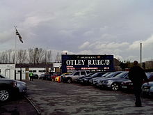
play home matches at Cross Green,[51] which was the venue for the Italy v USA fixture in the 1991 Rugby World Cup.