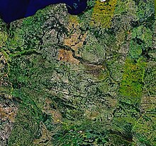
Outline of Poland
[1] It is bordered by Germany to the west; the Czech Republic and Slovakia to the south; Ukraine, Belarus and Lithuania to the east; and the Baltic Sea and Kaliningrad Oblast, a Russian exclave, to the north.
The total area of Poland is 312,679 km2 (120,728 sq mi),[2] making it the 69th largest country in the world and 9th in Europe.
Poland became a kingdom in 1025, and in 1569 it cemented a long association with the Grand Duchy of Lithuania by uniting to form the Polish–Lithuanian Commonwealth.
Poland lost over six million citizens in World War II, and emerged several years later as a socialist republic within the Eastern Bloc under strong Soviet influence.
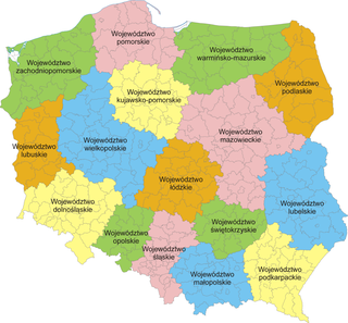
Poland is a unitary state made up of sixteen voivodeships (Polish: województwo).