Outline of the Faroe Islands
The following outline is provided as an overview of and topical guide to the Faroe Islands: Faroe Islands – autonomous province of the Kingdom of Denmark comprising the Faroe archipelago in the North Atlantic Ocean.
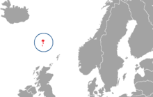
[1] The Faroe Islands are located between the Norwegian Sea and the North Atlantic Ocean, roughly equidistant between Iceland, Scotland, and Norway, and are considered a part of Northern Europe.
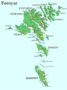
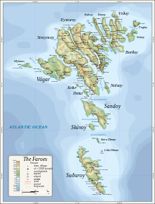
Geography of the Faroe Islands Regions of the Faroe Islands Administrative divisions of the Faroe Islands Regions of the Faroe Islands Municipalities of the Faroe Islands Demographics of the Faroe Islands Politics of the Faroe Islands Government of the Faroe Islands Foreign relations of the Faroe Islands The government of the Faroe Islands is a member of:[1] Military of the Faroe Islands List of municipalities of the Faroe Islands History of the Faroe Islands Culture of the Faroe Islands Economy of the Faroe Islands Wikimedia Atlas of the Faroe Islands