Overland Track
[6] The Overland Track spans the boundary between the Big River and Northern Tasmanian Aboriginal nations and may have been used as an access route.
Several artifacts and campsites containing various stone types and tools have been discovered between Pelion Plains and Lake St Clair, and early surveyors reported huts in the area.
[7] Europeans first explored Cradle Mountain in 1827 and 1828 with Joseph Fossey and Henry Hellyer surveying for the Van Diemen's Land Company.
Railway engineer Allan Stewart began surveying a route which led up the Mersey Valley up to what is now the middle of the Overland Track, but ran out of money before it could be completed.
[7] These tracks encouraged prospecting, and several mines were set up including coal near Barn Bluff, copper in Pelion Plains, Lake Windemere and Commonwealth Creek, tin in Mount Inglis, and tungsten in the Forth Valley.
They established huts, including Du Cane and Pine Valley, and burned the land to encourage fresh growth and game.
[7] In the 1910s Gustav and Kate Weindorfer began campaigning for the area from Cradle Mountain to Lake St Clair to be a national park.
During this transition, former trappers began building huts and guiding bushwalkers, including Paddy Hartnett, Weindorfer and Bob Quaile.
[9][7] The Overland Track has been managed by Tasmanian Parks and Wildlife Service since 1971, with the purpose of both improving access, and conserving World Heritage areas.
In 2024 it costs $295 AUD for an adult to walk the track from October to May (inclusive), not including the National Parks Pass, and walkers must travel from north to south on a prebooked starting date.
[11] In 1982, major Tasmanian national parks were recognised as a World Heritage Area, and federal funding was allocated to hut and track upgrades.
Highland Tasmanian weather can be unpredictable and cause hazardous track conditions, however most injuries and deaths from 1990 can be attributed to slips.
[13][14] In 2014 an international student from Victoria died from hypothermia between Kitchen Hut and Waterfall Valley due to inclement weather and inadequate clothing.
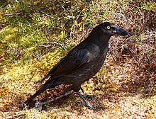
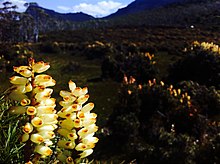
[18] The Overland Track traverses Cradle Mountain-Lake St Clair National Park, which is a significant habitat for Tasmania's endemic species.
Furthermore, 68% of the higher rainforest species recorded in alpine areas in Tasmania are present in the Cradle Mountain-Lake St Clair National Park.
[26] The oldest rocks in Cradle Mountain-Lake St Clair National Park are quartzites laid down in Precambrian times, and form a large base tilted towards the SSW and most exposed in the northern half of the track.
[28][29] In the Jurassic period, dolerite intruded through the crust, forming columns that cap every major mountain range in the national park.
[7] The Overland Track is listed as one of the best treks in the world by Lonely Planet and contains "craggy mountains [and] beautiful lakes and tarns".
[32] Tasmania in general is known for its remote, interesting and challenging wilderness, and in bushwalking circles the Overland Track is considered a comparatively accessible way of experiencing this part of the world.
Download coordinates as: Overnight use of these is prohibited except in an emergency The Cradle Mountain Run is an 82 km long Australian ultramarathon that follows the Overland Track.