Pacific, Missouri
In 1859, Franklin was incorporated as a fourth-class city and, in honor of the railroad, changed its name to Pacific.
The brigade entered Pacific at sunrise and burned major city structures, including the rail depot and a number of bridges.
Union authorities in nearby Saint Louis quickly dispatched three divisions of the 16th Army Corps originally destined for Gen. William Tecumseh Sherman in Atlanta to Pacific to deal with Cabell's troops, who had, by most accounts, set up four pieces of artillery around the town.
The casualties numbered about a dozen on each side, but Cabell's troops had done the bulk of their plundering earlier in the day.
It was used continuously until 1961, when regular service between Pacific and Saint Louis was discontinued due to declining ridership, and the Frisco Railroad abandoned the depot in 1976.
In the following years, the Meramec River flooded the southern extent of Pacific a number of times, most notably in 1895 and 1915.
The orchids were moved to the land, then called the Gray Summit Extension, the following year, but were restored to the original location of the garden when pollution waned.
The Missouri Botanical Garden kept the land, and over the next fifty years, amounting eventually to the 2,444 acre (9.89 km2) parcel currently known as Shaw Nature Reserve.
As Route 66 exploded in popularity through the 20th century, new attention was brought to Pacific, as cross-country motorists would stop in the city to eat and stay the night.
The Red Cedar Inn, The Al-Pac Motel and Beacon Court, constructed in 1933, 1942 and 1946, respectively, are examples of bed and breakfasts that opened in Pacific along Route 66.
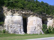
[12] The Jensen's Point overlook, named for Lars P. Jensen, the first president of the Henry Shaw Gardenway Association, was constructed in 1939 by the Civilian Conservation Corps atop the sandstone bluffs towering above the Meramec River on the east side of town.
Nike Base SL-60, as it was called, was one of four surface-to-air missile sites surrounding the Saint Louis metropolitan area in case of an imminent attack from the Soviet Union during the Cold War.
Interstate 44 was constructed throughout Missouri during the early 1960s, and when it opened in 1965, Pacific and Route 66 were bypassed immediately to the north by the highway.
[12] The Missouri Eastern Correctional Center, a medium-minimum security prison with the capacity to house 1,100 male inmates, was constructed immediately east of Pacific in 1979.
The Gustav Grauer Farm, located approximately 4 miles (6.4 km) north of Pacific in unincorporated Franklin County, was listed on the National Register of Historic Places in 1984.
Louis county line, which lies halfway on the blocks between Elm and Neosho streets.
Access to the Meramec River, through the Pacific Palisades Conservation Area, is located east of the city, adjacent to Eureka on the north side.
The city is located directly west from Eureka and 5 miles (8 km) east of Gray Summit.
The Red Cedar Inn, on the east end of town, was a meeting place for people around the country seeking out one of the oldest restaurants still standing on Route 66.
The population total also includes the Missouri Eastern Correctional Facility which houses over 1,000 inmates.