Payún Matrú
Payún Matrú is a shield volcano in the Reserva Provincial La Payunia of the Malargüe Department, south of the Mendoza Province in Argentina.
Payún Matrú, along with the Llancanelo, Nevado and Salado Basin volcanic fields, form the Payenia province.
Volcanic activity continued into the Holocene until about 515 years ago; oral tradition of local inhabitants contains references to earlier eruptions.
[9] Owing to the variety of volcanic landforms, the province was included in the 2010 Tentative List of UNESCO World Heritage Sites[10] and a number of potential geosites have been identified at Payún Matrú itself.
[18] Ignimbrites cover and flatten its northern and eastern slopes, while in the west and south lava domes and coulées[a] predominate; these have often rough surfaces and are difficult to traverse.
Matrú's highest active point field is the[18] 3,796 m (12,454 ft) high,[1] conical, eroded Payun stratovolcano.
[18] These edifices are up to 225 m (738 ft) high[33] and are associated with lava flows[18] and pyroclastic units;[6] the vents in the Los Volcanes group are spread across two separate belts.
[36] One of these is a slot canyon[28] known as La Pasarela,[37] where the structures of lava flows such as joints in the rocks and vesicles are clearly visible.
[6] The entire field covers an area of over 12,000 km2 (4,600 sq mi)[28] and some of its flows have reached the Llancanelo Lake north of Payún Matrú and the Salado River in the east.
[38] The estimated volumes of the entire Payún Matrú volcano are as large as 350 km3 (84 cu mi); the volcanic edifice was generated mostly through Strombolian and Hawaiian eruptions.
[39] The cones are aligned along easterly or northeasterly lineaments[20] which correlate with geological structures in the basement,[40] and appear to reflect the tectonic stresses underground.
[41] Among these lineaments is the La Carbonilla fracture which runs in east–west direction and crops out in the eastern part of the field; in the central sector it is hidden by the caldera and in the western it is buried by lava flows.
[42] The La Carbonilla fracture is a fault[41] that appears to have been an important influence on the development of the Payún Matrú complex in general.
[43] Fissural ridges and elongated chains of vents and cones highlight the control that lineaments exercise on the volcanic eruptions.
[28] The flow originates on the eastern side of the volcanic field in the La Carbonilla fault[38] and eventually splits up into a shorter ("Llancanelo lava flow", 60–63 km (37–39 mi) long[59][60]) northwestern and the longer southeastern branch[59] which reaches all the way to an alluvial terrace of the Salado River[61] in the La Pampa Province.
[77] Later during the Pliocene and Quaternary the slab steepened, and probably as a consequence volcanism in the land above increased,[82] reaching a peak between eight and five million years ago.
[16] The basement rock underneath Payún Matrú is formed by Mesoproterozoic (1,600–1,000 million years ago[46]) to Triassic rocks of the San Rafael Block, Mesozoic[83] (251.902 ± 0.024 to 66 million years ago[46]) to Paleogene sediments of the Neuquén Basin and Miocene lava flows[27] such as the Tertiary Patagonian basalts.
[12] The volcanic activity still relates to the subduction of the Nazca Plate beneath the South America Plate, however;[4] one proposed mechanism is that a Miocene change in the subduction regimen led to the development of extensional tectonics[78] and of faults that form the pathways for magma ascent,[18] while other mechanisms envisage changes in mantle characteristics.
These fields are subdivided on the basis of geochemical differences[42] and consist of two stratovolcanoes (Payún Matrú itself and Nevado) and many monogenetic volcanoes.
[17] Magnetotelluric[c] observations indicate the presence of a "plume"-like structure that rises from 200–400 km (120–250 mi) depth close to the edge of the Nazca Plate slab to underneath Payún Matrú; it may indicate that magma erupted in the volcanic field originates at such depths which would explain the ocean island basalt-like composition.
[109] The higher parts of Payún Matrú may have risen above the snowline during ice ages,[110] and periglacial landforms have been observed.
[18] The older volcanism appears to be located in the eastern part of the field where ages of 0.95 ± 0.5 to 0.6 ± 0.1 million years ago have been obtained by potassium-argon dating.
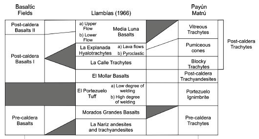
[116] The eastern volcanism is also known as the Pre-caldera basaltic unit; a western counterpart to it is probably buried beneath younger eruption products.
[24] The first volcanic activity occurred west and east of Payún Matrú and involved the emission of olivine basalt lava flows.
[e][35] This ignimbrite formation where it is not buried by younger eruption products[120] spreads radially around the caldera and reaches a maximum exposed thickness of 25 metres (82 ft);[25] it covers an area of about 2,200 km2 (850 sq mi) on the northern and southern sides of Payún Matrú,[18] and its volume is estimated to be about 25–33 km3 (6.0–7.9 cu mi).
[125] Oral tradition by a local indigenous tribe indicate that volcanic activity occurred within the last several centuries,[18][116] although no eruptions have been observed since the European settlement.
[17] Future volcanic eruptions would be unlikely to constitute a hazard given the low population density of the area, although roads might be interrupted and lava dams might form in rivers.