Pokhara
The city is on the shore of Phewa Lake, and sits at an average elevation of approximately 822 m above sea level.
By radiocarbon dating and investigating the alluvial deposits of Pokhara Valley, researchers have found that there were at least three large medieval earthquakes in 1000, 1255, and 1344 AD.
Up to 9 cubic kilometres of conglomerates, massive mud and silt show indications of one or several megafloods that emanated from the Sabche Cirque in the Annapurna range.
The people settled here included Parajuli Brahmins, who were asked to look after the Bindhyabasini temple and were given some land in that locality as Birta.
Most of Pokhara, at the time, was largely inhabited by Khas[18] (Brahmin, Chhetri and Dalits), Gurungs, Magars and Thakuri.
These camps have evolved into well-built settlements, each with a gompa (Buddhist monastery), chorten and its particular architecture, and Tibetans have become a visible minority in the city.
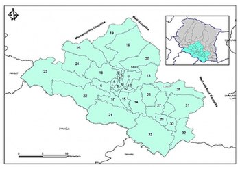
[28] Due to the high population density and the frequency of natural disasters, western Nepal is considered one of the most disaster-prone regions in the world.
As a result of this sharp rise in altitude the area of Pokhara has one of the highest precipitation rates in the country (3,350 mm/year or 131 inches/year in the valley to 5600 mm/year or 222 inches/year in Lumle).
[32] Even within the city, there is a noticeable difference in rainfall between the south and the north: The northern part at the foothills of the mountains experiences a proportionally higher amount of precipitation.
In the south of the city, a tributary of the Seti Gandaki River flowing out of the Phewa Lake disappears at Patale Chhango (पाताले छाँगो, Nepali for Hell's Falls, also called Davis Falls, after someone who supposedly fell in) into an underground gorge, to reappear 500 metres (1,600 feet) further south.
Lumle, 40 kilometres (25 miles) from Pokhara city center, receives the highest amount of rainfall (> 5600 mm/year or 222 inches/year) in the country.
[47] In terms of ethnicity/caste, 28.0% were Hill Brahmin, 16.1% Gurung, 15.4% Chhetri, 9.1% Magar, 6.8% Kami, 5.4% Newar, 3.3% Damai/Dholi, 2.8% Tamang, 2.0% Sarki, 1.4% Gharti/Bhujel, 1.4% Thakuri, 0.9% Badi, 0.9% Musalman, 0.9% Sanyasi/Dasnami, 0.8% Rai, 0.6% Tharu, 0.5% Kumal, 0.5% Thakali, 0.2% Chhantyal, 0.2% other Dalit, 0.2% Kalwar, 0.2% Kathabaniyan, 0.2% Sonar, 0.2% Teli, 0.1% Bengali, 0.1% Dura, 0.1% foreigners, 0.1% Gaine, 0.1% Ghale, 0.1% Hajjam/Thakur, 0.1% Halwai, 0.1% Koiri/Kushwaha, 0.1% Limbu, 0.1% Majhi, 0.1% Sherpa, 0.1% Sunuwar, 0.1% other Terai and 0.1% Yadav.
[54][55] The major contributors to the economy of Pokhara are manufacturing and service sector including tourism; agriculture and the foreign and domestic remittances.
The floor of the valley is plain, resembles Terai due to its gravel-like surface, and has slanted orientation from northwest to southeast.
Phewa Lake was slightly enlarged by damming which poses a risk of silting up due to the inflow during the monsoon.
The eastern Pokhara Valley receives irrigation water through a canal running from a reservoir by the Seti in the north of the city.
Every year, many people visit the location in order to travel to the Annapurna range and famous religious place muktinath.
Most upscale and starred hotels are on the southern shore of the Phewa Lake and southeastern fringes of the city where there are more open lands and unhindered view of the surrounding mountains.
In February 2004, International Mountain Museum (IMM)[72] was opened for public in Ratopahiro to boost the city's tourism.
The Pokhara region has a very strong military tradition with a significant number of its men being employed by the Nepali army.
Pokhara has extensive privately operated public transportation system running throughout the city, adjoining townships and nearby villages.
The public transport mainly consists of local and city buses, micros, micro-buses and metered-taxis.
The all-season Pokhara Airport with regular flights to Kathmandu and Mustang are operated by various domestic and a few international airlines.
[89] Additionally, the Kaski District Football Association (KDFA) organizes Safal Pokhara Gold Cup,[90] which is also a South Asian club-level tournament and ANFA organizes local Kaski district club-level Balram KC memorial football tournament.
The universal instruments used in Nepalese music include the madal (small leather drum), bansuri (bamboo flute), and saarangi.
During early and late 1990s, bands from Pokhara like Nepathya started their very successful fusion of western rock and pop with traditional folk music.
Approximately 14 national daily newspapers in Nepali are published in the city,[108][109][110] along with several other weekly and monthly news magazines.
The majority of the people in the city access internet through mobiles, numerous cyber cafes, and local wireless ISPs.
Wi-Fi hotspots by Nepal Telecom using Wi-MAX technology[114] were launched in February 2014, and are accessible in most parts of the city for a fee.
Pokhara also has the highest number of Gurkha soldiers, the majority of them belonging to Gurung and Magar ethnic groups, who were categorized as martial race by the British Army.