Polhill Anglo-Saxon cemetery
The cemetery was on a false crest on the hill, having wide views of the surrounding landscape, and was roughly 1 ha (2+1⁄2 acres) in size.
Specific archaeological excavation of the west area of the site took place in 1967 under the directorship of Brian Philp, and continued in 1978.
[1] Geologically, it sits upon a hard upper chalk layer, at the junction between the Darent Valley and North Downs scarp.
[2] Director of excavations Brian Philp thought this choice of location was "highly significant", allowing the "ancestors" to be buried in a "very dominant" position in the landscape.
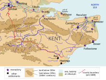
[3] With the advent of the Anglo-Saxon period in the fifth century CE, the area that became Kent underwent a radical transformation on a political, social, and physical level.
[4] Later Anglo-Saxon accounts attribute this change to the widescale invasion of Germanic language tribes from northern Europe, namely the Angles, Saxons, and Jutes.
[11] The earliest excavation of Anglo-Saxon Kentish graves was in the 17th century, when antiquarians took an increasing interest in the material remains of the period.
[12] In the ensuing centuries, antiquarian interest gave way to more methodical archaeological investigation, and prominent archaeologists like Bryan Faussett, James Douglas, Cecil Brent, George Payne, and Charles Roach Smith "dominated" archaeological research in Kent.
[12] The 1984–86 excavation revealed that the cemetery had followed clearly delineated limits, and that while a large space of hillside had been available, all of the burials were located within the 112- to 118-metre contours.
[14] The majority of skeletal remains had survived well due to the well-drained chalk geology, although in a number of graves, particularly those of children, they have almost entirely eroded.
[2] The graves were not evenly spaced in the cemetery, but often clustered together in what excavator Brian Philp suggested might have been family units.
[13] Philp believed that those inhumations containing spearheads, seaxes, or a shield would have been high status burials at the time.
[19] In August 1959, another road improvement revealed 3 further graves on the west side of the bank,[19] while in November 1959 and January 1960, schoolboys digging into the chalk uncovered two more.
On the west side of the road, a 40-foot wide strip of ground was removed, revealing one grave and potentially destroying others.
[1] The skeletal remains uncovered were studied by Elizabeth Rega of the University of Sheffield, funded by a 1993 grant from the British Academy.
[21] Archaeologist Martin Welch stated that Polhill remained the "most fully published" 7th and early 8th century cemetery in Kent until the excavation and publication of Springhead.