Poland–Russia border
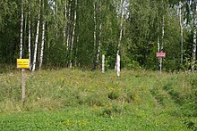
[7][10] The newly defined Soviet-Polish border included system of various engineered protection facilities up to a few kilometres wide such as ploughed strips of earth and no-man zone.
The economic model typical of the USSR, reinforced by the dominant military role of the Kaliningrad Oblast, meant that it did not establish closer cooperation with the neighboring Polish areas (Olsztyn, Gdańsk and Białystok Voivodeships), and generally for a decade it played no role in the Polish-Soviet trade, economic and cultural contacts.
The lack of cooperation between both entities made it difficult to even deal with such basic matters as regulating the functioning of watercourses that crossed the border, for example the Łyna River.
In such at the end of June 1945, the commander of the Soviet military administration of the Pruska Iława district handed over to the Polish authorities the areas up to 1 km north of this city, but in mid-October the Soviet authorities moved the borders by 1 km south, taking over the city and the surrounding area.
The village of Szczurkowo (Gmina Sępopol, Bartoszyce County) remained on the Polish side and constituted approximately one third of the town's buildings.
In order for the city to be a port, it was necessary for the USSR to respect the norms of international maritime law and to enable the navigation of merchant ships of all flags to Elbląg from the high seas through the Strait of Baltiysk.
However, this navigation was made impossible, thwarting plans to recreate both a significant port center and a full shipbuilding industry.
[13] From Bagrationovsk, lost by Poland, the railway line ran further west to Zinten (Cynty, now Kornevo) and Święta Siekierka (now Mamonovo), where there was another junction, north to Królewiec and south to Braniewo.
In April 1956, top Soviet authorities suggested that Warsaw designate a border line running south of Kaliningrad.
On August 8, in a note to the Minister of Foreign Affairs, Adam Rapacki, it was announced that diplomats of the Polish People's Republic had been instructed to exchange views.
Meanwhile, the Russians insisted on talks soon because, in their opinion, rumors were being spread in the West that the lack of border delimitation in this section called into question the Potsdam Agreement itself.
[14] The official demarcation of the boundary was finalized March 5, 1957, in the following terms: The Contracting Parties confirm that the existing State frontier between the Union of Soviet Socialist Republics and the Polish People's Republic in the sector adjoining the Baltic Sea, as established by the Berlin Conference in 1945, runs from frontier mark No.
However, other Polish proposals were taken into account: firstly, Poland was granted a relatively small area north of the town of Żytkiejmy, which enabled its inhabitants to farm, secondly, the Soviet Union agreed to give the Poland a one and a half kilometer section of the road connecting Szczurkowo with Ostre Bardo.
[19] More crossings are being built (Perły-Krylovo, Piaski-Baltiysk, Rapa-Ozyorsk), as the EU standards require Poland to operate at least seven for that border.
The move to construct the barrier came in response to Kaliningrad allowing from 1 October for a far greater level of international flights to its airport.