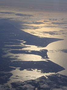
Portsea Island
Local people began adding the additional Island noun after the Portuseg (or Portusea) name in later times after the Saxon ēġ and ea meaning had become lost.
[8] Adjoining the eastern green belt, this extends into the heart of the Baffins neighbourhood which has a large pond and the grounds of Portsmouth College.
[citation needed] Buckland is a central neighbourhood at the heart of the island, directly north of Kingston and north-east of Landport.
However, this never materialised, in spite of the large gap between stations, and the existence of a signalled level crossing for many years (now a bridge).
Eastney is the most south-eastern area of Portsea island and forms part of the entrance into Langstone Harbour.
A small enclosed lagoon nicknamed 'The Glory Hole' is located on the southern side of Eastney Lake, and is refilled with Langstone Harbour's salt-water on high spring tides.
There is also a modest shopping centre on Fratton Road, The Bridge Centre, built on the site of a large former Co-op department store, now dominated by a large Asda supermarket, which reflects the working-class naval and industrial heritage of the Fratton district, with localised rather than centralised low-budget shops and cafés.
The large former Fratton railway goods yard was cleared in the late 1990s and early 2000s, making way for a retail park.
Residential parts of Landport are separated from its trade and distribution premises alongside its Albert Johnson Quay by the M275/A3 where the roads change designation.
[9] Mile End was consumed within the rapid urban development of the growing Landport and Buckland areas during the 19th and 20th centuries.
Milton is located on the south eastern side of Portsea Island and is bordered on the east by Langstone Harbour.
Milton was originally a small farming village on Portsea Island, surrounded by farmland until it was swallowed up by city expansion in the early years of the 20th century.
Portsmouth Football Club's Fratton Park stadium, despite its name, was built on land purchased from Milton Farm and is still located in the Milton Ward area of Portsmouth, south of the city's railway line, the boundary of the neighbouring Fratton Ward area.
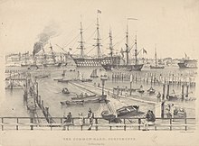
The Portsea area was formerly an expanse of common land located between the original walled town of Portsmouth and the nearby dockyard.
The Common, as it was named, began developing as a new settlement at the end of the 17th century as a response to overcrowding within the walls of the old town of Portsmouth.
This development worried the governor of the dockyard, as he feared that the new buildings would provide cover for any forces attempting to attack.
He was later a sealer, established the retail trade in preserved Maori heads and settled in Otago, New Zealand where he became that country's first art dealer before falling victim to his hosts in 1817 and being eaten.
[14] The area's proximity to the dockyard resulted in its taking massive bomb damage during World War II.
Rudmore is the name of a former residential district on the western side of Portsea Island near to the naval base and the present-day Portsmouth International Port.
On a modern map of Portsmouth, the route of the Southsea Railway can still clearly be seen from the arrangement of the newer housing and roads which replaced it.
To the north lie Tipner and Hilsea, and to the south are Kingston, Buckland and Commercial Road, the main retail area of the city.
Its park adjoining the feeder road terminating at the city centre (with motorway status) has large fields and an adventure playground.
Farlington, Drayton, Cosham, Wymering and Paulsgrove (including Port Solent) are suburbs of Portsmouth built on the mainland of Great Britain, not Portsea Island, all sharing the PO6 postcode area.