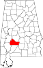
Prairie Bluff, Alabama
It was listed erroneously as Prairie Blue on Fielding Lucas' Geographic, Statistical, and Historical Map of Alabama, printed in Philadelphia in 1822.
The county seat had been a short distance from Prairie Bluff, in the community of Canton Bend, until moved to Barboursville (later renamed Camden) in 1833.
[2] The town was at its height in 1861, but declined rapidly in importance with the introduction of new railroads following the American Civil War.
[2] Portions of the site were inundated by the William "Bill" Dannelly Reservoir with the construction of the nearby Millers Ferry Lock and Dam in 1963.
The only physical feature that remains at the site today is the Prairie Bluff Cemetery, with marked graves dating from the 1830s to the 1860s.