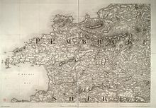
Preseli Mountains
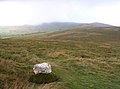
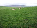
There are scattered settlements and small villages; the uplands provide extensive unenclosed grazing, and the lower slopes are mainly enclosed pasture.
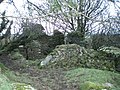
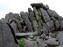
The former slate quarries at Rosebush on the southern edge of the hills worked the Aber Mawr Formation rocks whilst it is the dolerite tors of Carnmenyn which have been postulated, amongst other localities, as the source of the Stonehenge ‘bluestones’.
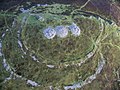
In contrast Foel Drygarn towards the eastern end of the range is formed from tuffs and lavas of the Fishguard Volcanic Group.
Cwm Gwaun is a major glacial meltwater channel which divides the northern tops such as Mynydd Carningli from the main mass of the hills.
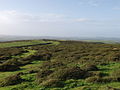
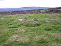
[8] The hills, much of which are unenclosed moorland or low-grade grazing with areas of bog, are surrounded by farmland and active or deserted farms.
There are no natural lakes in the hills, but a number of rivers, including the Gwaun, Nevern, Syfynwy and Tâf have their sources in the range.
There are three sites of special scientific interest (SSSIs): Carn Ingli and Waun Fawr (biological), and Cwm Dewi (geological).
[12] For example, they are an important UK site for the rare Southern damselfly, Coenagrion mercuriale,[13] where efforts to restore habitat were underway in 2015[14] and reported in 2020 to have been a success.
These, and a number of other minor roads and lanes, provide scenic routes popular with motoring, cycling and walking tourists.
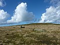
The larger part of the hills is designated under the Countryside and Rights of Way Act 2000 as 'open country' thereby enabling walkers the 'freedom to roam' across unenclosed land, subject to certain restrictions.
An east-west bridleway which runs the length of the main massif (known as Flemings' Way[17] or the Golden Road[1]), together with spurs to north and south, gives access to mountain bikers and horseriders.
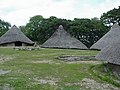
[20] Castell Henllys, on the A487 road between Eglwyswrw and Felindre Farchog is a reconstructed Iron Age settlement, illustrating what life may have been like in those times.
[22] Samuel Lewis's A Topographical Dictionary of Wales published in 1833 said of Maenclochog parish:Part of the Precelly mountain, which is the highest in South Wales... the ancient Welsh name of this mountain is Preswylva, signifying "a place of residence," and is derived from its having been the resort of the natives, as a place of security, in the intestine [sic] wars by which this part of the principality was agitated during the earlier periods of its history.
[56] The success of the protest was commemorated 60 years on, in 2009, with a plaque at each end of the Golden Road: one at the foot of Foel Drygarn near Mynachlog-ddu, and another near the B4329 at Bwlch-gwynt.