Geography (Ptolemy)
Originally written by Claudius Ptolemy in Greek at Alexandria around 150 AD, the work was a revision of a now-lost atlas by Marinus of Tyre using additional Roman and Persian gazetteers and new principles.
[1] Its translation – Kitab Surat al-Ard – into Arabic by Al-Khwarismi in the 9th century was highly influential on the geographical knowledge and cartographic traditions of the Islamic world.
However fragmentary papyri of later somewhat derivative works such as the Table of Noteworthy Cities have been found with the earliest, Rylands Library GP 522, dating to the early 3rd century.
[3][4] A letter written by the Byzantine monk Maximus Planudes records that he searched for one for Chora Monastery in the summer of 1295;[5] one of the earliest surviving texts may have been one of those he then assembled.
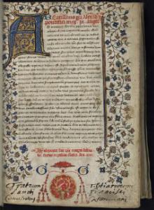
[a] The first Latin translation of these texts was made in 1406 or 1407 by Jacobus Angelus in Florence, Italy, under the name Geographia Claudii Ptolemaei.
Planudes and his assistants therefore probably had no pictorial models, and the success of their enterprise is proof that Ptolemy succeeded in his attempt to encode the map in words and numbers.
One such example is in an epistle by Cassiodorus (c.560 A.D.): “Tum, si vos notitiae nobilis cura inflammaverit, habetis Ptolemaei codicem, qui sic omnia loca evidenter expressit, ut eum cunctarum regionum paene incolam fuisse iudicetis.
Eoque fit, ut uno loco positi, sicut monachos decet, animo percurratis, quod aliquorum peregrinatio plurimo labore collegit.”(Institutiones 1, 25)[19].The existence of ancient recensions that differ fundamentally to the surviving manuscript tradition can be seen in the epitomes of Markianos by Stephanus:"Καὶ ἄλλοι οὕτως διὰ του π Πρετανίδες νῆσοι, ὡς Μαρκιανὸς καὶ Πτολεμαῖος.
[26] His Prime Meridian, of 0 longitude, ran through the Fortunate Isles, the westernmost land recorded,[27] at around the position of El Hierro in the Canary Islands.
[31] Pappus, writing at Alexandria in the 4th century, produced a commentary on Ptolemy's Geography and used it as the basis of his (now lost) Chorography of the Ecumene.
[32] Later imperial writers and mathematicians, however, seem to have restricted themselves to commenting on Ptolemy's text, rather than improving upon it; surviving records actually show decreasing fidelity to real position.
[33] Whereas previous Greco-Roman geographers such as Strabo and Pliny the Elder demonstrated a reluctance to rely on the contemporary accounts of sailors and merchants who plied distant areas of the Indian Ocean, Marinus and Ptolemy betray a much greater receptiveness to incorporating information received from them.
[34] When it comes to the account of the Golden Chersonese (i.e. Malay Peninsula) and the Magnus Sinus (i.e. Gulf of Thailand and South China Sea), Marinus and Ptolemy relied on the testimony of a Greek sailor named Alexandros, who claimed to have visited a far eastern site called "Cattigara" (most likely Oc Eo, Vietnam, the site of unearthed Antonine-era Roman goods and not far from the region of Jiaozhi in northern Vietnam where ancient Chinese sources claim several Roman embassies first landed in the 2nd and 3rd centuries).
[46] Its presence does strongly suggest the existence of earlier, now-lost maps which had been mathematically derived in the manner of Ptolemy,[41] al-Khwārazmi, or Suhrāb.
[45] Ptolemy's Geography was translated from Arabic into Latin at the court of King Roger II of Sicily in the 12th century AD.
In the first half of the 15th century, Florentine humanists used it mainly as a philological resource to understand the geography of ancient texts; Venetian cartographers attempted to reconcile Ptolemaic maps with portolan charts and medieval mappaemundi, and French and German scholars with an interest in astrology focused on Ptolemy's cosmographical concepts.
Ptolemy had mapped the whole world from the Fortunatae Insulae (Cape Verde[54] or Canary Islands) eastward to the eastern shore of the Magnus Sinus.
In his extreme east Ptolemy placed Serica (the Land of Silk), the Sinarum Situs (the Port of the Sinae), and the emporium of Cattigara.
[55] In Ptolemy's later and better-known Geography, a scribal error was made and Cattigara was located at eight and a half degrees South of the Equator.
This seems to be the best interpretation of the sketch map made by Alessandro Zorzi on the advice of Bartholomew Columbus (Christopher's brother) around 1506, which bears an inscription saying that according to the ancient geographer Marinus of Tyre and Christopher Columbus the distance from Cape St Vincent on the coast of Portugal to Cattigara on the peninsula of India Superior was 225 degrees, while according to Ptolemy the same distance was 180 degrees.
[60] Prior to the 16th century, knowledge of geography in the Ottoman Empire was limited in scope, with almost no access to the works of earlier Islamic scholars that superseded Ptolemy.
His Geography would again be translated and updated with commentary into Arabic under Mehmed II, who commissioned works from Byzantine scholar George Amiroutzes in 1465 and the Florentine humanist Francesco Berlinghieri in 1481.
[61][62] There are two related errors:[63] This suggests Ptolemy rescaled his longitude data to fit with a figure of 180,000 stadia for the circumference of the Earth, which he described as a "general consensus".