Qattara Depression
Due to its size and proximity to the shores of the Mediterranean Sea, studies have been made proposing to flood the area for various usages, such as the potential to generate hydroelectricity there.
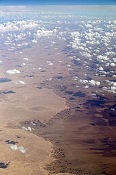
The northern side of the depression is characterised by steep escarpments up to 280 m (920 ft) high, marking the edge of the adjacent El Diffa plateau.
Within the Depression are salt marshes, under the northwestern and northern escarpment edges, and extensive dry lake beds that flood occasionally.
About a quarter of the region is occupied by dry lakes composed of hard crust and sticky mud, and occasionally filled with water.
[4] Groves of umbrella thorn acacia (Vachellia tortilis), growing in shallow sandy depressions, and Phragmites swamps represent the only permanent vegetation.
The largest gazelle population exists in the southwestern part of the Qattara Depression within a vast area of wetlands and soft sand.
[10] Several days each year in the months March to May khamsin winds blow in from the south and bring extremely high temperatures as well as sand and dust with them.
[11] The Depression is also inhabited by the nomadic Bedouin people and their flocks, with the uninhabited Moghra Oasis being important in times of water scarcity during the dry seasons.
During 1924–25, Ball again organised a survey party, this time with the sole purpose to triangulate the elevation on a westerly line from Wadi El Natrun.
[3] Knowledge about the geology of the Qattara Depression was greatly extended by Ralph Alger Bagnold, a British military commander and explorer, through numerous journeys in the 1920s and 1930s.
Six years later in 1933, Ball was the first to publish a proposal for flooding the region to generate hydroelectric power in his article "The Qattara Depression of the Libyan Desert and the possibility of its utilisation for power-production".
[14] A German communications officer stationed in the depression was cited by Gordon Welchman as being unintentionally helpful in the breaking of the Enigma machine code, due to his regular transmissions stating there was "nothing to report".
[15] The large size of the Qattara Depression and the fact that it falls to a depth of 133 m (436 ft) below mean sea level has led to several proposals to create a massive hydroelectric power project in northern Egypt rivalling that of the Aswan High Dam.
The proposals call for a large canal or tunnel being excavated from the Qattara due north of 55 to 80 kilometres (34 to 50 mi) depending on the route chosen to the Mediterranean Sea to bring seawater into the area.
[20] In 1957, the American Central Intelligence Agency proposed to President Dwight Eisenhower that peace in the Middle East could be achieved by flooding the Qattara Depression.
The resulting lagoon, according to the CIA, would have four benefits:[21] In the 1970s and early 1980s, several proposals to flood the area were made by Friedrich Bassler and the Joint Venture Qattara, a group of mainly German companies.
[22] Planning experts and scientists intermittently put forward potentially viable options, whether of a tunnel or canal, as an economic, ecological, and energy solution in Egypt, often coupled with the idea of new settlements.

Lower left bound: 28°36'30.74"N 26°14'31.08"E.
Upper right bound: 30°31'1.74"N 29° 8'51.83"E.