Ontario Highway 417
Highway 417 begins at the border between the provinces of Ontario and Quebec, east of which the four lane freeway continues as Autoroute 40.
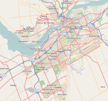
It passes through a forested and agricultural landscape en route to Ottawa, serving the communities of Hawkesbury, Vankleek Hill, Casselman, Limoges and Vars.
[3] After crossing a Via Rail line, the route dips south of Casselman and curves to the west at Exit 66 (County Road 7).
It roughly parallels the Via Rail line several kilometres north of the freeway, though significant deviations bypass the communities of Benoit and Limoges; the latter is served by Exit 79 (County Road 5).
[11] The freeway is elevated on a berm along some central portions of the route, providing views of downtown and the Gatineau Hills to the north.
[12] The route bisects central Ottawa with downtown and the Parliament Buildings to the north of the highway and residential neighbourhoods including the Glebe to the south.
Towards the Richmond Road interchange, the original western terminus of the Queensway, both sides of the freeway are lined by residential subdivisions as the highway transitions back to a suburban setting.
[3] The bypass was built as a two lane road with full control of access, avoiding existing properties and easily facilitating the upgrade to a freeway.
[3] Construction of the Queensway was driven by the Greber Plan, which was produced by Jacques Gréber under the direction of Prime Minister Mackenzie King in the late 1940s.
Although Gréber had been corresponding with King as early as 1936, World War II halted any plans from reaching fruition at that time.
[12] The plan called for the complete reorganization of Ottawa's road and rail network, and included amongst the numerous parkways was an east to west expressway along what was then a Canadian National Railway line.
[22][23] With the rail lines removed, construction of the new expressway got underway in 1957 when Queen Elizabeth visited Ottawa to open the first session of the 23rd Parliament.
On October 15, the Queen detonated dynamite charges from the Hurdman Bridge, which now overlooks the highway as it crosses the Rideau River, and formally dedicated the new project as the Queensway.
At the ceremony, premier Leslie Frost indicated that the entire project would cost C$31 million and emphasized the importance of the link to the Trans-Canada Highway.
[32] Planning was underway on a new freeway, Highway 417, that would run east of Ottawa from the Queensway, connecting with A-40 to provide a high-speed route to Montreal.
Highway 17, closely following the shore of the Ottawa River as it meanders towards Pointe-Fortune, was dangerous, narrow, and accident prone, earning it the nickname of "the killer strip".
By the end of that month, the easternmost 9 km (5.6 mi) of Highway 17 had been converted into a divided freeway,[37] and construction was progressing on the remainder of the route.
Prior to the completion of this section of freeway, Highway 17 followed Carling Avenue and March Road from Ottawa to west of Carp.
On October 31, 1969, a short extension to Moodie Drive was completed, including the realignment of that road for continuity north and south of Highway 417.
[50] Construction halted at the eastern edge of Kanata for several years while a study was conducted into the merits of building the highway in a trench through the established city.
[52] With the completion of the Kanata study during early 1976, work began to build the route through the city-centre in a depressed-grade; as a result all the crossings through that section pass over the freeway.
The construction saw a second two lane roadway built parallel to the existing route to create a divided freeway, a process known as twinning.
[57] On February 16, 2000, the Ministry of Transportation of Ontario (MTO) officially announced that Highway 417 would be extended to Arnprior over the next several years.
[62] Construction to twin the Arnprior Bypass portion of Highway 17, which included a new interchange at White Lake Road, began during the spring of 2009.
[66][67][68][failed verification] In August 2007, the Island Park Drive overpass underwent rapid bridge replacement, a novel process in Ontario at the time.
[69] The segment between Nicholas Street and Ottawa Road 174 was widened with an additional two lanes per direction, construction of which began in 2013 and completed on-time in 2015.
[70] This project involved the replacement of the Nicholas Street and Vanier Parkway overpasses as well as widening the Rideau River bridges.
Marie MPP David Orazietti has spearheaded a petition to have the entire highway four-laned from Arnprior to Sault Ste.
Marie,[79] similar to the campaign previously undertaken by his caucus colleague Rick Bartolucci regarding the extension of Highway 400.