Rachel's Tomb
Throughout history, the site was rarely considered a shrine exclusive to one religion and is described as being "held in esteem equally by Jews, Muslims, and Christians".
[20][21] Following a 1929 British memorandum,[12] in 1949 the UN ruled that the Status Quo—an arrangement approved by the 1878 Treaty of Berlin concerning rights, privileges and practices in certain Holy Places—applies to the site.
[23] Following the Israeli occupation of the West Bank in 1967, the site's position was formalized in 1995 under the Oslo II Accord in a Palestinian enclave (Area A), with a special arrangement making it subject to the security responsibility of Israel.
[31] In the Hebrew version given in Genesis,[32] Rachel and Jacob journey from Shechem to Hebron, a short distance from Ephrath, which is glossed as Bethlehem (35:16–21, 48:7).
— Genesis 35:19–20Tom Selwyn notes that R. A. S. Macalister, the most authoritative voice on the topography of Rachel's tomb, advanced the view in 1912 that the identification with Bethlehem was based on a copyist's mistake.
[48] In the late 7th century Arculf reported a tomb "of crude workmanship, without any adornment, surrounded by a stone coping" marked with the name "Rachel.
[51] Muhammad al-Idrisi (1154) writes, "Half-way down the road [between Bethlehem and Jerusalem] is the tomb of Rachel (Rahil), the mother of Joseph and of Benjamin, the two sons of Jacob peace upon them all!
[60] Nicolas of Poggibonsi (1346–50) describes the grave, including the "twelve stones", as 7 feet high and enclosed by a rounded tomb with three gates.
[45] Felix Fabri (1480–83) described it as being "a lofty pyramid, built of square and polished white stone";[63] He also noted a drinking water trough at its side and reported that "this place is venerated alike by Muslims, Jews, and Christians".
[63] Bernhard von Breidenbach of Mainz (1483) described women praying at the tomb and collecting stones to take home, believing that they would ease their labour.
"[a][58] In 1626, Franciscus Quaresmius visited the site and "heard from the elders that the tomb had sometime collapsed, but that it was continually restored in her memory and thus retained its dignity .
[76] Moses Poryat of Prague (1650) described a high dome, one side opening to a walled courtyard, and Jewish ritual observance:[77] The tomb of Rachel the Righteous is at a distance of 1½ miles from Jerusalem, in the middle of the field, not far from Bethlehem, as it says in the Torah.
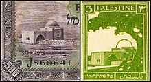
[78] In 1806 François-René Chateaubriand described it as "a square edifice, surmounted with a small dome: it enjoys the privileges of a mosque, for the Turks as well as the Arabs, honour the families of the patriarchs.
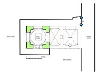
[77] He extended the building by constructing an adjacent vaulted ante-chamber on the east for Muslim prayer use and burial preparation, possibly as an act of conciliation.
Although Rachel's Tomb was only an hour and a half walk from the Old City of Jerusalem, many pilgrims found themselves very thirsty and unable to obtain fresh water.
[97] In 1868 a publication by the Catholic missionary society the Paulist Fathers noted that "[Rachel's] memory has always been held in respect by the Jews and Christians, and even now the former go there every Thursday, to pray and read the old, old history of this mother of their race.
When leaving Bethlehem for the fourth and last time, after we had passed the tomb of Rachel, on our way to Jerusalem, Father Luigi and I met a hundred or more Jews on their weekly visit to the venerated spot.
"[98] The Hebrew monthly ha-Levanon of August 19, 1869, rumored that a group of Christians had purchased land around the tomb and were in the process of demolishing Montefiore's vestibule in order to erect a church there.
In October 1875, Rabbi Zvi Hirsch Kalischer[clarification needed] purchased three dunams of land near the tomb intending to establish a Jewish farming colony there.
[100] In the 1883 volume of the PEF Survey of Palestine, Conder and Kitchener noted: "A modern Moslem building stands over the site, and there are Jewish graves near it...
[22] In view of this, the High Commissioner ruled that, pending appointment of the Holy Places Commission provided for under the Mandate, all repairs should be undertaken by the Government.
On December 11, 1948, the UN General Assembly passed Resolution 194 which called for free access to all the holy places in Israel and the remainder of the territory of the former Palestine Mandate of Great Britain.
In April 1949, the Jerusalem Committee prepared a document for the UN Secretariat in order to establish the status of the different holy places in the area of the former British Mandate for Palestine.
The UN ruled that the status quo, an arrangement approved by the Ottoman Decree of 1757 concerning rights, privileges and practices in certain Holy Places, apply to the site.
The Oslo II Accord of September 28, 1995 placed Rachel's Tomb in a Palestinian enclave (Area A), with a special arrangement making it – together with the main Jerusalem-Bethlehem access road – subject to the security responsibility of Israel.
[1] Initially the arrangement was intended to be the same as that for Joseph's Tomb near Nablus; however this was reconsidered following a significant reaction from Israel’s right-wing religious parties.
[citation needed] In the following years, the Israeli-controlled site became a flashpoint between young Palestinians who hurled stones, bottles and firebombs and IDF troops, who responded with tear gas and rubber bullets.
[120][121][122] In February 2010, Israeli Prime Minister Netanyahu announced that the tomb would become a part of the national Jewish heritage sites rehabilitation plan.
[2] The UN's special coordinator for the Middle East, Robert Serry, issued a statement of concern over the move, saying that the site is in Palestinian territory and has significance in both Judaism and Islam.
[124] The Jordanian government said that the move would derail peace efforts in the Middle East and condemned "unilateral Israeli measures which affect holy places and offend sentiments of Muslims throughout the world".